Interior of the Earth
Class 11 Geography · Fundamentals of Physical Geography · Chapter 3
163 members in the CBSE community
View all











CBSE Class 11 · Geography
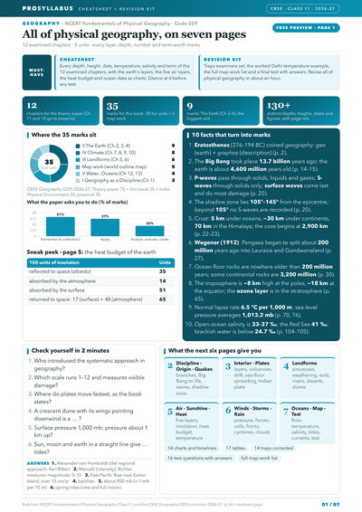
Earth's interior + plates: Unit II, 9 marks- Marks booster + cheatsheet: key concepts in 2 lines each, common traps
- 8 marks: Climate unit, Ch 7–10
- 5 marks: map work, covered
- 4 marks: ocean data as charts, Unit V
- Heat budget and five air layers as charts
- Common traps, corrected
CBSE Class 11 · Geography
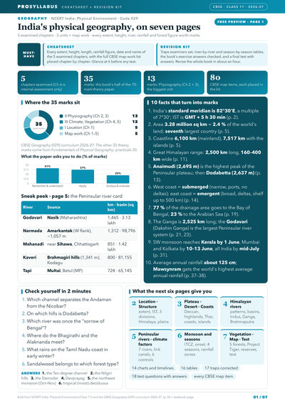
Physiography + Drainage: Unit II, 13 marks- Marks booster + cheatsheet: key concepts in 2 lines each, common traps
- 12 marks: Climate, Vegetation (Unit III)
- Full CBSE map-work list, chapter by chapter
- Indus, Ganga, Brahmaputra river systems
- Monsoon mechanism, onset and four seasons
- Common traps, corrected
CBSE Class 11 · Geography
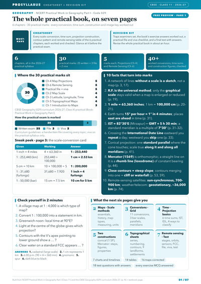
Projections, Remote Sensing: 5 marks each- Marks booster + cheatsheet: key concepts in 2 lines each
- 4 marks: Map Scale, conversions worked
- 4 marks: Latitude, Longitude and Time
- 4 marks: Topographical Maps, contours
- 5 marks: practical file and viva
- Conical and Mercator's construction steps
Summary
Because no one can reach the earth's centre, knowledge of its interior comes from direct sources (surface rocks, deep mines and drilling projects such as the Kola well at about 12 km, and volcanic magma) and indirect sources (temperature, pressure and density trends, meteors, gravitation, the magnetic field and especially seismic activity). An earthquake is the shaking of the earth caused by the sudden release of energy along a fault; the point of release is the focus (hypocentre) and the point on the surface above it is the epicentre. Earthquake waves are recorded on a seismograph and are of two kinds: body waves (P-waves, which are fast and travel through solids, liquids and gases, and S-waves, which travel only through solids) and surface waves, which are the most destructive. The fact that S-waves cannot pass through the liquid outer core creates a shadow zone and reveals the earth's layered structure. The earth consists of the crust (oceanic about 5 km, continental about 30 km, up to 70 km under the Himalayas), the mantle (with the weak asthenosphere as the source of magma), and the core (liquid outer core, solid inner core, the "nife" layer of nickel and iron). The chapter also classifies volcanoes — shield, composite, caldera, flood basalt provinces (like the Deccan Traps) and mid-ocean ridge volcanoes — and describes intrusive volcanic landforms such as batholiths, laccoliths, lapoliths, phacoliths, sills and dykes.