Class 6 › Social Science › Exploring Society: India and Beyond Locating Places on the Earth Class 6 Social Science · Exploring Society: India and Beyond · Chapter 1
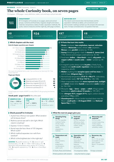
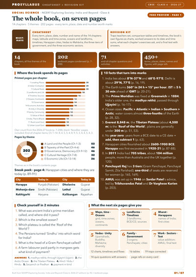
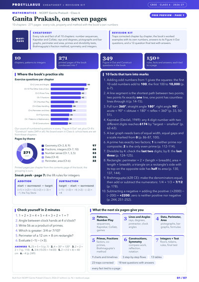
Practice all → Summary Questions & answers Practise this chapter → 5 Marks booster 5 kitsAll available subjects All 5 Class 6 kits: each book, by chapter ~7 pages per kit · Page 1 free ~140 days left · Annual exams · school dates varyMarks booster Your kit Social Science 14 chapters: maps to economic sectors Only 7 pages · Page 1 free ~140 days left · Annual exams · school dates varyMarks booster Your kit Science 12 chapters: food tests to the night sky Only 7 pages · Page 1 free ~140 days left · Annual exams · school dates varyMarks booster Your kit Mathematics 10 chapters: Kaprekar, Collatz to integers Only 7 pages · Page 1 free ~140 days left · Annual exams · school dates varyMarks booster Your kit English · Poorvi All 16 Poorvi texts, unit by unit Only 7 pages · Page 1 free ~140 days left · Annual exams · school dates varyMarks booster Your kit हिंदी All 13 मल्हार lessons + 16 grammar points Only 7 pages · Page 1 free ~140 days left · Annual exams · school dates vary
Browse all 6 kits → A map is a drawing that represents an area as seen from above, and an atlas is a collection of maps. Maps come in three broad kinds — physical, political and thematic — and rely on three main components: distance (shown by a scale, such as 1 cm = 500 m), direction (the four cardinal directions north, east, south and west, plus intermediate ones), and symbols (standardised drawings fixed by the Survey of India). Because the Earth is nearly a sphere, it cannot be flattened onto paper without distortion, so a globe represents it best. Any place can be located using a grid of two coordinates. Latitudes are parallels running east–west, measured from the Equator (0°) to the poles (90°N and 90°S), and they relate to climate — torrid near the Equator, temperate further away, frigid near the poles. Longitudes are meridians running pole to pole, measured from the Prime (Greenwich) Meridian fixed in 1884, from 0° to 180° east or west. Longitude also measures time: the Earth turns 360° in 24 hours, so 15° equals one hour. Indian Standard Time is 5 hours 30 minutes ahead of GMT. The International Date Line lies near 180°. Ancient India used its own prime meridian through Ujjayinī (Ujjain).
Scale
The ratio that tells how a distance on a map relates to the actual distance on the ground, e.g. 1 cm = 500 m.
Latitude
An imaginary line (parallel) measuring distance north or south of the Equator, from 0° to 90°.
Longitude
An imaginary line (meridian) measuring distance east or west of the Prime Meridian, from 0° to 180°.
Prime Meridian
The 0° longitude passing through Greenwich, fixed in 1884 as the international reference line.
Indian Standard Time
India's single standard time, which is 5 hours 30 minutes ahead of Greenwich Mean Time (GMT).
International Date Line
An imaginary line near 180° longitude; crossing it changes the date by one day.
Q2 What are the three main components of a map? Answer Q3 Why is a globe a better model of the Earth than a flat map? Answer Q4 What is the latitude of the Equator and of the poles? Answer Q5 How does latitude relate to climate? Answer Q6 What is the Prime Meridian and when was it fixed? Answer Q7 Why does longitude help us measure time? Answer Q8 How far ahead of GMT is Indian Standard Time? Answer Q9 What happens when you cross the International Date Line? Answer Q10 Which ancient Indian city had its own prime meridian? Answer Q1 Observe the picture above. What do you notice? Where does the water in the lake come from? Answer Q2 Observe the picture above. What do you notice? Who made the road and why? Answer Q3 Observe the picture above. What do you notice? What could be the activities of people living in the small house? What could be their history? Their future? Answer Q4 Write down your answers and discuss them with your classmates. Answer Q5 Now, looking at the picture on the facing page, what questions come to your mind? Write them down. Answer Q6 How do you propose to find answers to the questions related to these two images? Answer Q1 1. What is a map and how do we use it? What are its main components? Answer Q2 2. What are coordinates? How can latitude and longitude be used to mark any location on the Earth? Answer Q3 3. How are local time and standard time related to longitude? Answer Q1 On the map in Fig. 1.1 given on page 8 — 1. Mark the hospital. Answer Q2 On the map in Fig. 1.1 given on page 8 — 2. What is the meaning of the blue-coloured areas? Answer Q3 On the map in Fig. 1.1 given on page 8 — 3. Which is farther away from the railway station — the school, the Nagar Panchayat or the public garden? Answer Q4 As a class activity, form groups of three or four students each. Let each group try to draw a map of your school and some of the streets or roads that lead to it, and a few neighbouring buildings. At the end, compare all the maps and discuss. Answer Q1 Draw a simple map of a school's playground. Let us assume it is a rectangle, 40 m in length and 30 m in width. Draw it precisely with your ruler on a scale of 1 cm = 10 m. Answer Q2 Now measure the diagonal of the rectangle. How many centimetres do you get? Using the scale, calculate the real length of the playground's diagonal, in metres. Answer Q1 Consider the map of the small city again. Identify the correct and incorrect statements in the list below: 1. The market is north of the hospital. Answer Q2 Consider the map of the small city again. Identify the correct and incorrect statements in the list below: 2. The museum is southeast of the bank. Answer Q3 Consider the map of the small city again. Identify the correct and incorrect statements in the list below: 3. The railway station is northwest of the hospital. Answer Q4 Consider the map of the small city again. Identify the correct and incorrect statements in the list below: 4. The lake is northwest of the apartment blocks. Answer Q5 Taking your school as the starting point, do you know approximately in which cardinal direction your home is located? Discuss with your teacher and your parents. Answer Q1 Draw a rough map of your locality or your village, including your home, school and a few other important landmarks. Show the cardinal directions and use a few of the symbols shown in Fig. 1.2 on page 12 to mark some important features. Answer Q1 Using the same terms, write down your move if you play black and respond with the same move. Answer Q1 If the globe or atlas in your class has well-marked latitudes and longitudes, try to note down approximate values for the latitude and longitude of (1) Mumbai, (2) Kolkata, (3) Singapore, (4) Paris. Answer Q1 Two friends, one sitting in Porbandar (Gujarat) and the other in Tinsukia (Assam), are speaking on the phone late afternoon. The latter remarks that the sun has set in Assam and it's now dark. The former is surprised and says, “But it's still full daylight here!” Explain why. And, as a class activity, calculate the difference in local time between those two cities. (Hint: for now, consider the difference in longitude between Porbandar and Tinsukia to be 30°; later, you can find out the precise value.) Answer Q1 Return to the two friends sitting in Gujarat and Assam. Use this example to explain the difference between local time and standard time. Answer Q1 1. Returning to page 10 and to Fig. 5.2 in Chapter 5 of this textbook, taking the scale to be 2.5 cm = 500 km, calculate the real distance from the estuary of the Narmada River to the estuary of the Ganga river. (Hint: round off your measurement on the map to an easy number.) Answer Q2 2. Why is it 5:30 pm in India when it is 12 pm or noon in London? Answer Q3 3. Why do we need symbols and colours in the map? Answer Q4 4. Find out what you have in the eight directions from your home or school. Answer Q5 5. What is the difference between local time and standard time? Discuss it in groups, with each group writing an answer in 100 to 150 words. Compare the answers. Answer Q6 6. Delhi's and Bengaluru's latitudes are 29°N and 13°N; their longitudes are almost the same, 77°E. How much will be the difference in local time between the two cities? Answer Q7 7. Mark the following statements as true or false; explain your answers with a sentence or two. All parallels of latitude have the same length. Answer Q8 7. Mark the following statements as true or false; explain your answers with a sentence or two. The length of a meridian of longitude is half of that of the Equator. Answer Q9 7. Mark the following statements as true or false; explain your answers with a sentence or two. The South Pole has a latitude of 90°S. Answer Q10 7. Mark the following statements as true or false; explain your answers with a sentence or two. In Assam, the local time and the IST are identical. Answer Q11 7. Mark the following statements as true or false; explain your answers with a sentence or two. Lines separating the time zones are identical with meridians of longitude. Answer Q12 7. Mark the following statements as true or false; explain your answers with a sentence or two. The Equator is also a parallel of latitude. Answer Q13 8. Solve the crossword below. Across 1. Lets you squeeze a huge area into your map Answer Q14 8. Solve the crossword below. Across 4. A convenient sphere Answer Q15 8. Solve the crossword below. Across 5. The longest parallel of latitude Answer Q16 8. Solve the crossword below. Across 6. The place the Prime Meridian is attached to Answer Q17 8. Solve the crossword below. Across 8. So convenient to find your way Answer Q18 8. Solve the crossword below. Across 10. A measure of the distance from the Equator Answer Q19 8. Solve the crossword below. Down 2. A measure of the distance from the Prime Meridian Answer Q20 8. Solve the crossword below. Down 3. These two together allow us to locate a place Answer Q21 8. Solve the crossword below. Down 6. What latitudes and longitudes together create Answer Q22 8. Solve the crossword below. Down 7. The time we all follow in India Answer Q23 8. Solve the crossword below. Down 9. On top of the world Answer Q24 8. Solve the crossword below. Down 11. An abbreviation for a line across which the day and date change Answer
What is a map?
A A photograph of the Earth taken from the Moon B A list of all the countries of the world C A drawing or representation of an area as seen from above D A solid model of a mountain
Flashcards & interactive practice 
 5
5