Complete Solutions and Summary of Water Resources – NCERT Class 10, Geography, Chapter 3 – Summary, Questions, Answers, Extra Questions
Detailed summary and explanation of Chapter 3 ‘Water Resources’ covering the importance of water, water scarcity, water conservation, rainwater harvesting, multipurpose river projects, dams, irrigation, and water dispute issues with all question answers, activities, and extra questions from NCERT Class X Geography.
Updated: 9 months ago
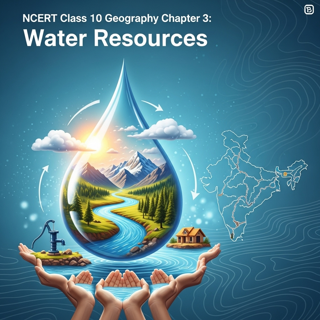
Water Resources
Chapter 3: Geography - Complete Study Guide | NCERT Class 10 Notes & Questions 2025
Comprehensive Chapter Summary - Water Resources Class 10 NCERT
Overview
- Chapter Purpose: Explains water as renewable resource via hydrological cycle; 3/4 Earth water-covered but freshwater scarce. Scarcity due to over-exploitation, unequal access, population growth. By 2025, 2 billion in absolute scarcity. Figure 3.1: Water Scarcity images. Focus: Conservation, management for health, food security, ecosystems. Key Insight: Scarcity not just low rain but misuse; urban examples. Jal Jeevan Mission (JJM): 55 lpcd potable water to rural households by ensuring tap functionality (Economic Survey 2020-21).
- Water Scarcity and Need for Conservation: Abundance misleading; scarcity from population, over-use for food, industry, urban lifestyles. Irrigation largest consumer; over-exploitation lowers groundwater. Industrialization/urbanization pressure freshwater; cities over-pump. Atal Bhujal Yojana: Behavioral change in 7 states for conservation.
- Expanded Relevance 2025: Climate change worsens scarcity; focus on pollution, floods. Update: Annual Report Ministry Jal Shakti 2022-23.
- Exam Tip: Link scarcity causes to examples; use Figure 3.4 for maps; know projects, harvesting methods.
- Broader Implications: Water vital for life; mismanagement causes ecological crisis, health hazards.
Multi-Purpose River Projects and Integrated Water Resources Management
- Ancient Hydraulic Structures: Dams, lakes, canals from ancient times (e.g., Sringaverapura flood channeling 1st century B.C.; Chandragupta Maurya systems; Bhopal Lake 11th century; Hauz Khas tank 14th century). Modern India continues with dams for irrigation, power, flood control, etc. Figure 3.2: Hirakud Dam. Dams: Barriers creating reservoirs; classified by structure (timber, embankment, masonry), height (low, medium, high).
- Role and Opposition: Nehru's 'temples of modern India' for development. Integrate agriculture/industry. But opposition: Affect natural flow, sedimentation, habitat loss, migration issues, trigger floods, earthquakes, diseases, salinization. Bhadu Song: Damodar floods. PM Krishi Sinchayee Yojana: Irrigation access, efficiency ('per drop more crop').
- Sardar Sarovar Dam: Narmada River; covers 4 states; irrigates drought-prone areas (18.45 lakh ha Gujarat, 2.46 lakh ha Rajasthan, 37,500 ha Maharashtra).
- Inter-State Disputes: E.g., Krishna-Godavari (Karnataka/AP objections to Maharashtra's Koyna diversion).
- Map: Figure: India Major Rivers and Dams.
Rainwater Harvesting
- Traditional Methods: Viable alternative; ancient knowledge of regimes, soils. Hills: 'Guls'/'Kuls' (Western Himalayas). Floodplains: Inundation channels (Bengal). Arid: 'Khadins' (Jaisalmer), 'Johads' (Rajasthan). Tankas: Underground tanks Rajasthan (e.g., Phalodi 6.1m deep); store 'palar pani' purest. Rooftop: Common Rajasthan; collect post-first rain.
- Modern Adaptations: Figure 3.3: Rooftop via hand pump/abandoned dugwell. Tamil Nadu: Compulsory rooftop. Meghalaya: Shillong rooftop despite high rain nearby (Cherrapunjee); 15-25% household water. Gendathur (Mysuru): 200 households collect 50,000 litres/house annually. Figure 3.4: Are You a Water Harvester? Figure 3.5: Traditional Kaza village tank. Figure 3.6: Thar rooftop to underground tanka.
- Bamboo Drip Irrigation: Meghalaya 200-year system; bamboo pipes tap springs, 18-20 litres enter, reduce to 20-80 drops/minute at plant. Figures 3.7: Pictures 1-6 showing system.
Floods
- Causes and Impacts: Heavy rain, sedimentation, poor drainage. Devastate life/property, soil erosion, land degradation. Figure: Flood-prone areas map.
- Basic Safety Precautions: Info to others, emergency kit, elevated grounds, avoid water/electrics/animals, etc.
SEO Note: Why This Guide?
Top-ranked for 'Water Resources Class 10 notes 2025'—free, with 60 Q&A from PDF, quizzes. Integrates conservation insights.
Key Themes
- Scarcity Variations: Quantitative (over-use) vs qualitative (pollution).
- Projects Details: Pros/cons, examples. Figure: Map.
- Harvesting Links: Traditional to modern for sustainability.
- Critical Thinking: Why dams opposed? How harvesting helps? Pollution impacts.
Cases for Exams
Use map for dams/rivers; discuss scarcity examples; analyze JJM objectives.
Exercises Summary
- Focus: Expanded to 60 Q&A from PDF: 20 short (2M), 20 medium (4M), 20 long (8M) based on NCERT exercises + similar.
- Project Idea: List disputes; info on pollution; enact dispute scene.


As an Amazon Associate, ProSyllabus earns from qualifying purchases. Prices shown are subject to change.
Test your CBSE Class 10 Board Examination prep
Quizzes
10 questions · ~10 minutes · instant rank & AI diagnosis
Class 10 English — Nelson Mandela: Long Walk to Freedom (Practice Quiz)
Chemical Reactions and Equations Fundamentals — Free CBSE Class 10 Board Examination Quiz
Class 10 English — A Triumph of Surgery (Practice Quiz)
Class 10 English — A Letter to God (Practice Quiz)
Reading Comprehension Passages Fundamentals | CBSE Class 10 Board Examination
कक्षा 10 संस्कृत — रचना-प्रयोगः (अभ्यास प्रश्नोत्तरी)
कक्षा 10 संस्कृत — वाच्य-परिवर्तनम् (अभ्यास प्रश्नोत्तरी)
कक्षा 10 संस्कृत — कारक एवं विभक्ति (अभ्यास प्रश्नोत्तरी)
कक्षा 10 संस्कृत — समास परिचय (अभ्यास प्रश्नोत्तरी)
कक्षा 10 संस्कृत — प्रत्ययाः (अभ्यास प्रश्नोत्तरी)
कक्षा 10 संस्कृत — अव्ययानि (अभ्यास प्रश्नोत्तरी)
कक्षा 10 संस्कृत — उपसर्गाः (अभ्यास प्रश्नोत्तरी)
कक्षा 10 संस्कृत — धातुरूप परिचय (अभ्यास प्रश्नोत्तरी)
कक्षा 10 संस्कृत — शब्दरूप परिचय (अभ्यास प्रश्नोत्तरी)
कक्षा 10 संस्कृत — सन्धिः (अभ्यास प्रश्नोत्तरी)
कक्षा 10 संस्कृत — संज्ञा एवं परिभाषा (अभ्यास प्रश्नोत्तरी)
कक्षा 10 संस्कृत — वर्णविचारः (अभ्यास प्रश्नोत्तरी)
कक्षा 10 संस्कृत — भूकंपविभीषिका (अभ्यास प्रश्नोत्तरी)
कक्षा 10 संस्कृत — सूक्तयः (अभ्यास प्रश्नोत्तरी)
कक्षा 10 संस्कृत — विचित्रः साक्षी (अभ्यास प्रश्नोत्तरी)
कक्षा 10 संस्कृत — सौहार्दं प्रकृतेः शोभा (अभ्यास प्रश्नोत्तरी)
कक्षा 10 संस्कृत — सुभाषितानि (अभ्यास प्रश्नोत्तरी)
कक्षा 10 संस्कृत — जननी तुल्यवत्सला (अभ्यास प्रश्नोत्तरी)
कक्षा 10 संस्कृत — शिशुलालनम् (अभ्यास प्रश्नोत्तरी)
कक्षा 10 संस्कृत — व्यायामः सर्वदा पथ्यः (अभ्यास प्रश्नोत्तरी)
कक्षा 10 संस्कृत — बुद्धिर्बलवती सदा (अभ्यास प्रश्नोत्तरी)
कक्षा 10 संस्कृत — शुचिपर्यावरणम् (अभ्यास प्रश्नोत्तरी)
कक्षा 10 हिंदी — टोपी शुक्ला (अभ्यास प्रश्नोत्तरी)
कक्षा 10 हिंदी — सपनों के-से दिन (अभ्यास प्रश्नोत्तरी)
कक्षा 10 हिंदी — हरिहर काका (अभ्यास प्रश्नोत्तरी)
कक्षा 10 हिंदी — पतझर में टूटी पत्तियाँ, कारतूस (अभ्यास प्रश्नोत्तरी)
कक्षा 10 हिंदी — अब कहाँ दूसरे के दुख से दुखी होने वाले (अभ्यास प्रश्नोत्तरी)
कक्षा 10 हिंदी — गिरगिट (अभ्यास प्रश्नोत्तरी)
कक्षा 10 हिंदी — तीसरी कसम के शिल्पकार शैलेंद्र (अभ्यास प्रश्नोत्तरी)
कक्षा 10 हिंदी — तताँरा-वामीरो कथा (अभ्यास प्रश्नोत्तरी)
कक्षा 10 हिंदी — डायरी का एक पन्ना (अभ्यास प्रश्नोत्तरी)
कक्षा 10 हिंदी — बड़े भाई साहब (अभ्यास प्रश्नोत्तरी)
कक्षा 10 हिंदी — तोप, कर चले हम फ़िदा, आत्मत्राण (अभ्यास प्रश्नोत्तरी)
कक्षा 10 हिंदी — मधुर-मधुर मेरे दीपक जल (अभ्यास प्रश्नोत्तरी)
कक्षा 10 हिंदी — पर्वत प्रदेश में पावस (अभ्यास प्रश्नोत्तरी)
कक्षा 10 हिंदी — मनुष्यता (अभ्यास प्रश्नोत्तरी)
कक्षा 10 हिंदी — बिहारी के दोहे (अभ्यास प्रश्नोत्तरी)
कक्षा 10 हिंदी — मीरा के पद (अभ्यास प्रश्नोत्तरी)
कक्षा 10 हिंदी — कबीर की साखी (अभ्यास प्रश्नोत्तरी)
कक्षा 10 हिंदी — मैं क्यों लिखता हूँ (अभ्यास प्रश्नोत्तरी)
कक्षा 10 हिंदी — साना-साना हाथ जोड़ि (अभ्यास प्रश्नोत्तरी)
कक्षा 10 हिंदी — माता का अँचल (अभ्यास प्रश्नोत्तरी)
कक्षा 10 हिंदी — संस्कृति (अभ्यास प्रश्नोत्तरी)
कक्षा 10 हिंदी — नौबतखाने में इबादत (अभ्यास प्रश्नोत्तरी)
कक्षा 10 हिंदी — एक कहानी यह भी (अभ्यास प्रश्नोत्तरी)
कक्षा 10 हिंदी — लखनवी अंदाज़ (अभ्यास प्रश्नोत्तरी)
कक्षा 10 हिंदी — बालगोबिन भगत (अभ्यास प्रश्नोत्तरी)
कक्षा 10 हिंदी — नेताजी का चश्मा (अभ्यास प्रश्नोत्तरी)
कक्षा 10 हिंदी — संगतकार (अभ्यास प्रश्नोत्तरी)
कक्षा 10 हिंदी — यह दंतुरित मुसकान, फसल (अभ्यास प्रश्नोत्तरी)
कक्षा 10 हिंदी — उत्साह, अट नहीं रही है (अभ्यास प्रश्नोत्तरी)
कक्षा 10 हिंदी — आत्मकथ्य (अभ्यास प्रश्नोत्तरी)
कक्षा 10 हिंदी — राम-लक्ष्मण-परशुराम संवाद (अभ्यास प्रश्नोत्तरी)
कक्षा 10 हिंदी — सूरदास के पद (अभ्यास प्रश्नोत्तरी)
Class 10 English — For Anne Gregory (Practice Quiz)
Class 10 English — The Tale of Custard the Dragon (Practice Quiz)
Class 10 English — Fog (Practice Quiz)
Class 10 English — The Trees (Practice Quiz)
Class 10 English — Amanda! (Practice Quiz)
Class 10 English — The Ball Poem (Practice Quiz)
Class 10 English — How to Tell Wild Animals (Practice Quiz)
Class 10 English — A Tiger in the Zoo (Practice Quiz)
Class 10 English — Fire and Ice (Practice Quiz)
Class 10 English — Dust of Snow (Practice Quiz)
Class 10 Health & PE — Doping and Ethics in Sports (Practice Quiz)
Class 10 Health & PE — Adolescent Health and Wellbeing (Practice Quiz)
Class 10 Health & PE — Diseases: Communicable and Non-communicable (Practice Quiz)
Class 10 Health & PE — The Olympic Movement (Practice Quiz)
Class 10 Health & PE — Common Sports Injuries and Prevention (Practice Quiz)
Class 10 Health & PE — First Aid and Safety Education (Practice Quiz)
Class 10 Health & PE — Yoga and Healthy Living (Practice Quiz)
Class 10 Health & PE — Posture and Postural Deformities (Practice Quiz)
Class 10 Health & PE — Food and Nutrition for Health (Practice Quiz)
Class 10 Health & PE — Effects of Exercise on the Body Systems (Practice Quiz)
Class 10 Health & PE — Physical Fitness, Wellness and Lifestyle (Practice Quiz)
Class 10 Health & PE — Physical Education: Meaning and Importance (Practice Quiz)
Class 10 English — The Book That Saved the Earth (Practice Quiz)
Class 10 English — Bholi (Practice Quiz)
Class 10 English — The Necklace (Practice Quiz)
Class 10 English — The Making of a Scientist (Practice Quiz)
Class 10 English — Footprints Without Feet (Practice Quiz)
Class 10 English — A Question of Trust (Practice Quiz)
Class 10 English — The Midnight Visitor (Practice Quiz)
Class 10 English — The Thief’s Story (Practice Quiz)
Class 10 English — The Proposal (Practice Quiz)
Class 10 English — The Sermon at Benares (Practice Quiz)
Class 10 English — Madam Rides the Bus (Practice Quiz)
Class 10 English — Mijbil the Otter (Practice Quiz)
Class 10 English — Glimpses of India (Practice Quiz)
Class 10 English — From the Diary of Anne Frank (Practice Quiz)
Class 10 English — Two Stories about Flying (Practice Quiz)
Class 10 Social Science — Consumer Rights (Practice Quiz)
Class 10 Social Science — Globalisation and the Indian Economy (Practice Quiz)
Class 10 Social Science — Money and Credit (Practice Quiz)
Class 10 Social Science — Sectors of the Indian Economy (Practice Quiz)
Class 10 Social Science — Development (Practice Quiz)
Class 10 Social Science — Outcomes of Democracy (Practice Quiz)
Class 10 Social Science — Political Parties (Practice Quiz)
Class 10 Social Science — Gender, Religion and Caste (Practice Quiz)
Class 10 Social Science — Federalism (Practice Quiz)
Class 10 Social Science — Power-sharing (Practice Quiz)
Class 10 Social Science — Lifelines of National Economy (Practice Quiz)
Class 10 Social Science — Manufacturing Industries (Practice Quiz)
Class 10 Social Science — Minerals and Energy Resources (Practice Quiz)
Class 10 Social Science — Agriculture (Practice Quiz)
Class 10 Social Science — Water Resources (Practice Quiz)
Class 10 Social Science — Forest and Wildlife Resources (Practice Quiz)
Class 10 Social Science — Resources and Development (Practice Quiz)
Class 10 Social Science — Print Culture and the Modern World (Practice Quiz)
Class 10 Social Science — The Age of Industrialisation (Practice Quiz)
Class 10 Social Science — The Making of a Global World (Practice Quiz)
Class 10 Social Science — Nationalism in India (Practice Quiz)
Class 10 Social Science — The Rise of Nationalism in Europe (Practice Quiz)
Class 10 Science — Our Environment (Practice Quiz)
Class 10 Science — Magnetic Effects of Electric Current (Practice Quiz)
Class 10 Science — Electricity (Practice Quiz)
Class 10 Science — The Human Eye and the Colourful World (Practice Quiz)
Class 10 Science — Light – Reflection and Refraction (Practice Quiz)
Class 10 Science — Heredity (Practice Quiz)
Class 10 Science — How do Organisms Reproduce? (Practice Quiz)
Class 10 Science — Control and Coordination (Practice Quiz)
Class 10 Science — Life Processes (Practice Quiz)
Class 10 Science — Carbon and its Compounds (Practice Quiz)
Class 10 Science — Metals and Non-metals (Practice Quiz)
Class 10 Science — Acids, Bases and Salts (Practice Quiz)
Class 10 Maths — Probability (Practice Quiz)
Class 10 Maths — Statistics (Practice Quiz)
Class 10 Maths — Surface Areas and Volumes (Practice Quiz)
Class 10 Maths — Areas Related to Circles (Practice Quiz)
Class 10 Maths — Circles (Practice Quiz)
Class 10 Maths — Some Applications of Trigonometry (Practice Quiz)
Class 10 Maths — Introduction to Trigonometry (Practice Quiz)
Class 10 Maths — Coordinate Geometry (Practice Quiz)
Class 10 Maths — Triangles (Practice Quiz)
Class 10 Maths — Arithmetic Progressions (Practice Quiz)
Class 10 Maths — Quadratic Equations (Practice Quiz)
Class 10 Maths — Pair of Linear Equations in Two Variables (Practice Quiz)
Class 10 Maths — Polynomials (Practice Quiz)
Class 10 Maths — Real Numbers (Practice Quiz)
Class 10 Science — Chemical Reactions and Equations (Practice Quiz)
Political Science: Democratic Politics II Practice Quiz | CBSE Class 10 Board Examination
Economics: Understanding Economic Development Practice Quiz | CBSE Class 10 Board Examination
Hindi A/B (Kshitij II / Sparsh II / Kritika II / Sanchayan II) Practice Quiz | CBSE Class 10 Board Examination
Carbon and Its Compounds Advanced Challenge | CBSE Class 10 Board Examination

Group Discussions
No forum posts available.

