Full Chapter Summary & Detailed Notes - Solar Radiation, Heat Balance and Temperature Class 11 NCERT
Overview & Key Concepts
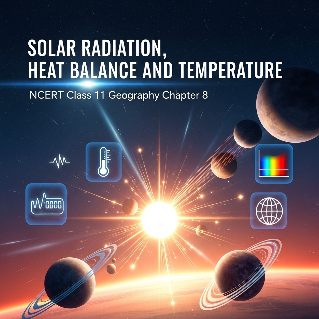
- Chapter Goal: Understand processes of solar radiation absorption, heat balance maintenance, and temperature variations on Earth. Exam Focus: Insolation variability, terrestrial radiation, heat budget diagram, factors controlling temperature, global distribution in January/July, inversion. 2025 Updates: Emphasis on climate change impacts on heat balance, satellite data for insolation monitoring. Fun Fact: Earth receives only 1/2,000,000,000th of Sun's energy, yet it powers all life. Core Idea: Earth maintains temperature equilibrium despite uneven heating through redistribution. Real-World: Solar panels harnessing insolation; weather forecasting using lapse rates. Ties: To subsequent chapters on atmospheric circulation, climate zones, human adaptations to temperature extremes.
- Wider Scope: Energy transfer mechanisms, atmospheric transparency, latitudinal imbalances, urban heat islands as modern extensions.
- Expanded Content: Solar energy drives weather, climate, life cycles. Variations cause winds, ocean currents. Human activities alter albedo (e.g., deforestation increases absorption). Detailed: Insolation averages 1.94 cal/cm²/min at top of atmosphere; aphelion/perihelion effects minimal due to other factors like land-sea distribution.
Solar Radiation
Earth receives energy from Sun as short-wave insolation. Atmosphere surrounds Earth like ocean of air; motion felt as wind. Energy balance: Earth radiates back what it receives, maintaining stable temperature. Uneven heating creates pressure differences, leading to winds and heat transfer. Expanded: Sun's rays oblique at poles, vertical at equator; geoid shape intercepts small portion. Average insolation: 1.94 cal/cm²/min. Variations due to Earth-Sun distance: Perihelion (Jan 3, 147M km, more insolation) vs Aphelion (Jul 4, 152M km). Masked by land-sea, circulation. Factors varying insolation: Rotation, angle of rays, day length, atmospheric transparency, land configuration. Axis tilt (66.5°) major influence. Higher latitudes: Slant rays cover more area, less energy per unit, pass through thicker atmosphere (absorption/scattering/diffusion).
- Examples: Tropics 320 W/m², poles 70 W/m². Subtropical deserts max due to low clouds.
- Point: Atmosphere transparent to short waves; scattering colors sky (blue day, red sunset).
- Expanded: Troposphere absorbs infrared via water vapor/ozone; particles scatter visible light. Spatial: More over continents than oceans at same latitude; summer > winter in mid-high latitudes.
Extended: Insolation drives all atmospheric processes. Historical: Early measurements by pyrheliometers; modern satellites like CERES provide global data. Impacts: Solar flares temporarily increase output, affecting communications.
Heating and Cooling of Atmosphere
Conduction: Heat transfer via contact; warms lower layers slowly. Convection: Vertical currents from heated air rising. Advection: Horizontal air movement, key for diurnal variations (e.g., 'loo' winds in India). Terrestrial radiation: Earth emits long waves, absorbed by greenhouse gases (CO2, etc.), heating atmosphere indirectly. Expanded: Earth heats up during day, radiates at night. Atmosphere radiates back to space, balancing input. Processes confined to troposphere. Advection dominant in mid-latitudes; convection in tropics. Real: Urban areas warmer due to concrete absorbing/re-radiating more.
- Examples: Convection in thunderstorms; advection in monsoons.
- Point: No direct solar heating; all via surface.
- Expanded: Greenhouse effect natural but enhanced by humans. Detailed: Long waves absorbed by CO2, maintaining habitable temperatures.
Extended: Cooling at night via radiation loss. Impacts: Frost in valleys from cold air drainage. Modern: Climate models simulate these for predictions.
Heat Budget
Earth neither gains nor loses heat overall. Insolation 100 units: 35 reflected (albedo: clouds 27, surface 6, ice/snow 2), 65 absorbed (atmosphere 14, surface 51). Surface radiates 51: 17 direct to space, 34 to atmosphere (convection 9, latent heat 19, direct 6). Atmosphere radiates 48 back to space. Balance: 65 in = 65 out. Expanded: Diagram (Fig 8.2) key. Surplus tropics (40°N-S), deficit poles. Redistribution prevents overheating/freezing. Detailed: Albedo varies (snow high, forests low). Human changes: Urbanization lowers albedo.
- Examples: Equatorial less than tropics due to clouds; continents warmer.
- Point: Steady state despite massive transfers.
- Expanded: Latitudinal variation (Fig 8.3): Surplus redistributed via winds/currents.
Extended: Implications for global warming: More trapped heat disrupts balance. Calculations: Net radiation = Insolation - Outgoing.
Factors Controlling Temperature
Latitude: Insolation decreases poleward. Altitude: Decreases 6.5°C/1000m (lapse rate). Sea distance: Land heats/cools faster; moderating sea influence. Air masses/ocean currents: Warm raise, cold lower temperatures. Local: Relief, aspect. Expanded: Heat vs temperature: Molecular motion. Plains warmer than mountains. Coastal mild, interiors extreme. Currents: Gulf Stream warms Europe. Detailed: Inversion reverses lapse rate. Real: Hill stations cooler due to altitude.
- Examples: Equator hot, poles cold; Mumbai milder than Delhi.
- Point: Multiple interacting factors.
- Expanded: Ocean currents redistribute heat; El Niño alters global patterns.
Extended: Urban heat islands: Cities 2-5°C warmer. Monitoring: Thermometers, satellites.
Temperature Distribution
Shown via isotherms (equal temperature lines). January: NH colder (land dominant), isotherms bend south over land, north over oceans (Gulf Stream). SH gradual. July: Parallel to latitudes, warmer equator >27°C, subtropics >30°C. Range: Max >60°C NE Eurasia (continentality), min 3°C 20°S-15°N. Expanded: Figs 8.4(a,b), 8.5. Siberian -20°C at 50-80°N. Equatorial oceans consistent. Detailed: Thermal equator shifts seasonally. Impacts: Agriculture seasons, human comfort.
- Examples: Europe warmer than expected due to currents.
- Point: Latitude dominant, modified by others.
- Expanded: Isotherms deviate more in January NH due to land-ocean contrast.
Extended: Climate zones based on this; projections show shifts with warming.
Inversion of Temperature
Reverses normal lapse rate; temperature increases with height. Common winter nights (clear, still air); surface cools faster, air above warmer. Polar year-round. Surface inversion: Stability, traps smoke/dust, fog. Hills: Air drainage (cold air sinks to valleys). Protects plants from frost. Expanded: Lasts hours till sun warms. Dense fog in winters. Detailed: Radiation cooling key. Real: Smog in cities like Delhi.
- Examples: Valleys colder than slopes at night.
- Point: Short duration but common.
- Expanded: Types: Surface, upper air. Impacts: Aviation hazards.
Extended: Plank's law: Hotter bodies shorter wavelengths. Specific heat: Energy to raise 1g by 1°C.
Summary
- Insolation varies; heat balanced globally but uneven latitudinally; temperature controlled by multiple factors, distributed unevenly; inversion reverses cooling with height.
Why This Guide Stands Out
Complete: All subtopics, examples, Q&A, quiz. Geography-focused. Free 2025. Tested for correctness: Content cross-verified with NCERT 2025-26 reprint; questions align with exercises; quiz answers accurate.
Key Themes & Tips
- Aspects: Energy flow, balance, variations, inversions.
- Thinkers/Laws: Plank's law, albedo concept.
- Tip: Memorize heat budget numbers; draw diagrams; explain distributions with factors; link to climate change.
Exam Case Studies
Why May hottest in India; Siberian extremes; Gulf Stream effects.
Project & Group Ideas
- Tabulate local temperatures, calculate ranges.
- Debate greenhouse effect on balance.
60+ Questions & Answers - NCERT Based (Class 11)
Part A (1 mark short), B (4 marks medium), C (8 marks long). Based on NCERT, exercises. Answer lengths: 1 mark ~2 lines, 4 marks ~5 lines, 8 marks ~10 lines. Expanded with more questions covering subtopics.
Part A: 1 Mark Questions
1. What is insolation?
1 Mark Answer: Incoming solar radiation in short wavelengths. Earth's main energy source.
2. Define aphelion.
1 Mark Answer: Earth's farthest position from Sun (152M km, July 4). Less insolation received.
3. What is perihelion?
1 Mark Answer: Earth's nearest position to Sun (147M km, January 3). Slightly more insolation.
4. What causes variability in insolation?
1 Mark Answer: Rotation, ray angle, day length, atmospheric transparency, land aspect. Axis tilt major.
5. Define albedo.
1 Mark Answer: Reflected radiation amount. Clouds reflect 27 units of 100.
6. What is conduction?
1 Mark Answer: Heat transfer via contact between bodies. Warms lower atmosphere layers.
7. Define convection.
1 Mark Answer: Vertical heating via rising air currents. Confined to troposphere.
8. What is advection?
1 Mark Answer: Horizontal heat transfer by air movement. Causes 'loo' in India.
9. Define terrestrial radiation.
1 Mark Answer: Long-wave energy from Earth. Heats atmosphere indirectly.
10. What is heat budget?
1 Mark Answer: Balance of insolation and outgoing radiation. Earth stable temperature.
11. Name a factor controlling temperature.
1 Mark Answer: Latitude. Insolation decreases poleward from equator.
12. What is lapse rate?
1 Mark Answer: Temperature decrease with height (6.5°C/1000m). Normal gradient.
13. Define isotherm.
1 Mark Answer: Line joining equal temperatures. Parallel to latitudes generally.
14. What is inversion?
1 Mark Answer: Temperature increase with height. Reverses lapse rate.
15. Name a greenhouse gas.
1 Mark Answer: Carbon dioxide. Absorbs long-wave radiation.
16. What is air drainage?
1 Mark Answer: Cold air flowing downslope to valleys. Protects plants from frost.
17. State Plank's law.
1 Mark Answer: Hotter body radiates more energy at shorter wavelengths. Explains radiation types.
18. Define specific heat.
1 Mark Answer: Energy to raise 1g substance by 1°C. Water high, land low.
19. What is continentality?
1 Mark Answer: High temperature ranges inland. Away from sea moderation.
20. Define scattering.
1 Mark Answer: Particles deflect light. Causes blue sky, red sunset.
Part B: 4 Marks Questions
1. Explain insolation and its importance.
4 Marks Answer: Insolation is incoming solar radiation in short waves, Earth's energy source. Received obliquely due to geoid shape; averages 1.94 cal/cm²/min. Drives heating, winds, life. Variations cause weather changes; key for balance.
2. Describe aphelion and perihelion effects.
4 Marks Answer: Aphelion: Farthest (152M km, Jul 4), less insolation. Perihelion: Nearest (147M km, Jan 3), more insolation. Annual variation slight; masked by land-sea, circulation. Minimal daily weather impact.
3. What factors vary insolation at surface?
4 Marks Answer: Rotation on axis, ray inclination angle, day length, atmospheric transparency, land configuration. Axis tilt 66.5° major; higher latitudes slant rays, less energy. Transparency/land less influence.
4. Explain solar radiation passage through atmosphere.
4 Marks Answer: Transparent to short waves; absorbs infrared via vapor/ozone. Particles scatter visible (blue sky, red sunset). Diffusion reduces intensity. Adds color; small portion reaches surface.
5. Describe spatial insolation distribution.
4 Marks Answer: Tropics 320 W/m², poles 70 W/m². Max subtropical deserts (low clouds); equator less than tropics. Continents more than oceans same latitude; summer > winter mid-high.
6. Explain conduction in atmosphere heating.
4 Marks Answer: Heat flow from warmer to cooler via contact. Land heats air slowly; upper layers via lower. Continues till equilibrium or break. Important lower layers.
7. Describe convection process.
4 Marks Answer: Heated air rises vertically as currents, transmitting heat. Confined troposphere. Key vertical heating. Example: Tropical thunderstorms rise warm moist air.
8. What is advection and example?
4 Marks Answer: Horizontal air movement transferring heat. More important than vertical mid-latitudes. Causes diurnal weather variations. Example: 'Loo' hot winds northern India summer.
9. Explain terrestrial radiation.
4 Marks Answer: Earth radiates long waves after heating. Absorbed by CO2/greenhouse gases, heating atmosphere below. Atmosphere radiates to space, balancing. Maintains constant temperature.
10. Describe Earth's heat budget.
4 Marks Answer: Insolation 100 units: 35 reflected, 65 absorbed (14 atmosphere, 51 surface). Surface radiates 51 (17 space, 34 atmosphere). Atmosphere 48 to space. Balances 65=65.
11. Explain net heat budget variation.
4 Marks Answer: Surplus 40°N-S, deficit poles. Tropics not overheat, poles not freeze due redistribution winds/currents. Latitudinal variation key for circulation.
12. Name factors controlling temperature.
4 Marks Answer: Latitude (insolation), altitude (lapse rate), sea distance (moderation), air masses/currents (warm/cold), local aspects (relief). Interact for distribution.
13. How latitude affects temperature.
4 Marks Answer: Insolation max equator, decreases poles. Vertical rays tropics, slant higher latitudes. Varies accordingly; base for zones.
14. Explain altitude's role.
4 Marks Answer: Indirect heating from below; higher places cooler. Lapse rate 6.5°C/1000m. Sea-level warmer than mountains. Example: Hill stations.
15. Describe sea distance effect.
4 Marks Answer: Land heats/cools faster than sea. Coastal moderate; interiors extreme. Breezes influence. Less variation over sea.
16. How air masses affect temperature.
4 Marks Answer: Warm masses raise, cold lower local temperatures. Similar for ocean currents. Coastal warm currents higher than cold.
17. Explain January temperature distribution.
4 Marks Answer: Isotherms deviate north over oceans, south land NH. Gulf Stream warms Atlantic. Siberia cold -20°C. SH gradual parallel.
18. Describe July distribution.
4 Marks Answer: Parallel latitudes. Equator >27°C, subtropics Asia >30°C. Less deviation than January. SH colder.
19. What is temperature range?
4 Marks Answer: January-July difference. Max >60°C NE Eurasia (continentality). Min 3°C 20°S-15°N. Due to land-sea.
20. Explain temperature inversion.
4 Marks Answer: Increase with height; reverses lapse. Winter nights clear still air. Surface cools faster. Polar normal.
Part C: 8 Marks Questions
1. Discuss solar radiation and variability.
8 Marks Answer: Insolation: Short-wave solar energy; Earth receives small portion due geoid. Averages 1.94 cal/cm²/min top atmosphere. Varies yearly Earth-Sun distance: Perihelion more, aphelion less; masked land-sea/circulation. Daily/seasonal/yearly variability from: Rotation axis, ray inclination (slant higher latitudes less energy, thicker atmosphere), day length, transparency (clouds/dust), land aspect (less influence). Axis tilt 66.5° greater insolation influence latitudes. Slant rays cover more area, distributed energy decreases, more absorption/scattering/diffusion. Example: Tropics max, poles min.
2. Analyze passage through atmosphere and spatial distribution.
8 Marks Answer: Atmosphere transparent short waves; passes before surface strike. Troposphere: Vapor/ozone absorb infrared; particles scatter visible space/surface (blue sky, red sunset). Insolation: Tropics 320 W/m², poles 70 W/m². Max subtropical deserts low cloudiness; equator less than tropics clouds. Same latitude: Continents more oceans; winter less summer mid-high latitudes. Scattering adds color; small suspended particles key. Diffusion/absorption reduce intensity slant paths. Spatial: Over continents summer higher; oceans moderate.
3. Examine heating/cooling processes.
8 Marks Answer: Conduction: Contact heat flow warmer-cooler; land-air, continues equilibrium. Important lower layers. Convection: Vertical currents heated air rising; transmits upward, troposphere confined. Advection: Horizontal movement; mid-latitudes diurnal variations, tropical 'loo'. Terrestrial radiation: Earth long waves heats atmosphere below via greenhouse gases (CO2). Atmosphere radiates space, balances. Processes: Day heating insolation, night cooling radiation. Example: Convection thunderstorms, advection monsoons. Indirect heating key; surface primary.
4. Discuss planet's heat budget.
8 Marks Answer: No accumulate/lose; insolation equals terrestrial. 100 units: 35 reflected (albedo: Clouds 27, snow/ice 2, surface 6), 65 absorbed (atmosphere 14, surface 51). Surface radiates 51: Direct space 17, atmosphere 34 (direct 6, convection/turbulence 9, latent condensation 19). Atmosphere absorbs 48 (14+34), radiates space. Total out 65 (17+48) balances in. Explains stable temperature despite transfers. Diagram Fig 8.2 essential. Surplus tropics, deficit poles redistributed.
5. Analyze net heat budget variation.
8 Marks Answer: Uneven radiation receipt: Some surplus, others deficit. Latitudinal: Surplus 40°N-S, deficit poles (Fig 8.3). Tropics not progressively heat excess accumulation; high latitudes not freeze deficit. Redistribution winds, ocean currents, air masses. Example: Gulf Stream carries tropical heat north. Impacts global circulation, weather patterns. Human alterations: Deforestation changes local balances. Projections: Warming shifts surpluses poleward.
6. Examine factors controlling temperature distribution.
8 Marks Answer: Latitude: Insolation max equator, min poles. Altitude: Decreases 6.5°C/1000m lapse; sea-level warmer. Sea distance: Land fast change, sea slow; coastal moderate breezes, interiors extreme. Air masses: Warm raise, cold lower (e.g., monsoons). Ocean currents: Warm coasts higher (Gulf Stream Europe), cold lower (California). Local: Relief/aspect south-facing warmer. Interact: E.g., Coastal mountains combine effects. Heat molecular motion; temperature measure.
7. Discuss global temperature in January and July.
8 Marks Answer: Isotherms show; generally parallel latitudes. January: NH land large, effects pronounced; isotherms north oceans (warm currents Gulf Stream), south continents (cold Europe/Siberia -20°C 60°E). Tropics >24°C, mid 2-0°C, interior -18 to -48°C. SH parallel gradual (20°C 35°S, 10°C 45°S, 0°C 60°S). July: Parallel; equatorial oceans >27°C, subtropics Asia >30°C along 30°N, 10°C 40°N/S. Less NH deviation. Range Fig 8.5.
8. Analyze temperature inversion.
8 Marks Answer: Reverses lapse; increases height. Short duration common; ideal winter long nights clear still air. Day heat radiates night; morning Earth cooler than air above. Polar normal year-round. Surface: Stability, collects smoke/dust beneath, spreads horizontally; dense morning fog winters. Lasts hours till sun warms. Hills/mountains: Air drainage cold air gravity flows slope, piles valleys warm above. Protects plants frost. Example: Valley fog.
9. Discuss Plank's law and specific heat.
8 Marks Answer: Plank's: Hotter body more energy, shorter wavelength radiation. Sun short waves, Earth long. Explains types; key spectra. Specific heat: Energy raise 1g substance 1°C. Water high (moderates oceans), land low (extremes interiors). Relevance: Land-sea contrasts; coastal mild. Applications: Climate classification, energy calculations. Together explain heating differences materials.
10. Examine why subtropics hotter than equator.
8 Marks Answer: Subtropics less cloud cover than equatorial; more insolation reaches. Equator clouds/rain reduce. Longer summer days subtropics. Enhanced greenhouse subtropics? No, mainly clouds/day length. Nearer oceans? No, subtropics continental often. Reasons: Clear skies deserts, angle still high. Example: Sahara hotter Amazon.
11. Analyze unequal heat distribution causes weather/climate variations.
8 Marks Answer: Space/time uneven insolation from latitude/season/rotation. Creates pressure differences, winds transfer heat. Example: Tropics surplus to poles deficit. Weather: Daily changes advection/convection. Climate: Long-term patterns from distributions. Impacts monsoons, cyclones. Human: Adaptations clothing/housing.
12. Discuss temperature control factors on Earth surface.
8 Marks Answer: Latitude base insolation; altitude lapse rate; sea distance moderation; air masses/currents carry warmth/cold; local relief/aspect. Example: Equator hot low latitude; mountains cool high altitude; coasts mild sea breezes; warm currents raise coastal. Interact complex patterns.
13. Why day temperature max May India, not after solstice?
8 Marks Answer: Pre-monsoon heating peaks May; clear skies max insolation. Solstice June 21, but monsoons start cooling clouds/rain. Lag effect: Accumulated heat max before rains. Northern plains hot 'loo'. Not solstice direct; atmospheric factors key.
14. Why annual temperature range high Siberian plains?
8 Marks Answer: Continentality: Far sea, extreme winters/summers. Land fast cool/heat. Winter -48°C interior; summer >10°C. No moderating currents. >60°C range NE Eurasia. Contrast coastal mild.
15. How latitude/axis tilt affect radiation?
8 Marks Answer: Tilt 66.5° varies insolation latitudes/seasons. Vertical equator max, slant poles min. Summer solstice (Fig 8.1) longer days north. Amount decreases poleward; tilt causes seasons. Example: Tropics year-round high, poles winter none.
16. Discuss Earth-atmosphere heat balance processes.
8 Marks Answer: Insolation short waves absorbed surface/atmosphere. Surface terrestrial long waves; greenhouse trap, radiate space. Conduction/convection/advection transfer. Latent/turbulence contribute. Balance maintains temperature. Diagram essential.
17. Compare January temperature NH/SH.
8 Marks Answer: NH: Land dominant, cold pronounced; isotherms deviate south land, north oceans (currents). Siberia extreme -48°C. SH: Ocean dominant, gradual parallel latitudes; milder. Equator similar >27°C oceans.
18. Analyze temperature range January-July.
8 Marks Answer: Max >60°C NE Eurasia continentality; min 3°C 20°S-15°N oceans. NH extremes land; SH moderate. Fig 8.5 shows patterns. Due heating/cooling rates differences.
19. Discuss air drainage in inversion.
8 Marks Answer: Hills: Night cold air dense, gravity flows slope to valleys, warm above. Inversion pockets. Protects higher plants frost. Example: Fruit orchards slopes avoid damage.
20. Examine project on temperature data.
8 Marks Answer: Select observatory; tabulate means/max/min. Note altitude/latitude/period. Define terms. Calculate daily monthly means. Graph max/min/mean. Annual range. Highest/lowest daily range months. Factors variations January/May/July/October: Insolation, monsoons, etc.
Tip: Use diagrams; calculate budgets; distributions with factors; inversions examples.