Full Chapter Summary & Detailed Notes - Movements of Ocean Water Class 11 NCERT
Overview & Key Concepts
- Chapter Goal: Understand ocean water movements: horizontal (currents, waves), vertical (tides, upwelling/sinking). Factors: Temperature, salinity, density, sun/moon/winds, gravity, Coriolis. Exam Focus: Definitions, types (waves, tides, currents), characteristics, importance, effects on climate/human activities, maps/figures. 2025 Updates: Emphasis on climate change impacts on currents (e.g., Gulf Stream weakening), El Niño effects. Fun Fact: Bay of Fundy has world's highest tides (15-16m). Core Idea: Ocean dynamics influence global climate, marine life, navigation. Real-World: Ocean currents aid shipping; tides for renewable energy. Ties: To previous chapters on water cycle, salinity; next on ecosystems. Expanded: Movements redistribute heat/energy, affect weather patterns like monsoons, support biodiversity hotspots. Detailed: Primary forces (solar heating, wind, gravity, Coriolis); secondary (density differences). Global significance: Thermohaline circulation as 'conveyor belt' regulating climate.
- Wider Scope: Energy transfer, tidal power potential, current disruptions from pollution/plastics. Environmental concerns: Ocean acidification affecting upwelling zones.
- Expanded Content: Ocean covers 71% earth; movements prevent stagnation, oxygenate water. Horizontal: Currents (gyres), waves (wind-driven). Vertical: Tides (gravitational), upwelling (nutrient-rich). Human impacts: Overfishing in mixing zones, tidal barrages for energy in Canada/France.
Introduction
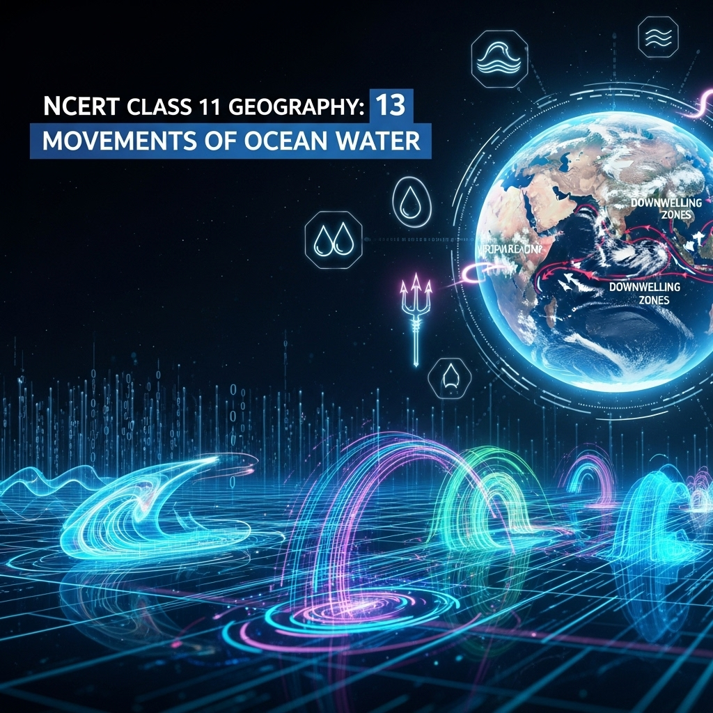
Ocean water dynamic; influenced by temperature, salinity, density, external forces (sun, moon, winds). Movements: Horizontal (currents, waves), vertical (tides, upwelling/sinking). Currents: Continuous flow definite direction; waves: Horizontal motion without water displacement. Tides: Rise/fall twice daily from gravitational pull. Upwelling: Cold subsurface water rises; sinking: Surface water descends. Expanded: Physical characteristics create density gradients driving vertical motions. Winds transfer energy for waves/currents. Importance: Redistribute heat, nutrients; affect climate, marine ecosystems. Detailed: Sun heats equator more, creating thermal gradients; moon's pull stronger due to proximity. Real-world: El Niño disrupts currents, causing global weather anomalies like droughts/floods.
- Examples: Gulf Stream warms Europe; tidal bores in rivers.
- Point: Movements essential for ocean circulation, preventing stagnation.
- Expanded: Density differences from salinity (evaporation/precipitation) and temperature drive thermohaline circulation. Coriolis deflects currents right (N.Hemisphere), left (S.Hemisphere).
Extended: Vertical motions include surges from meteorological effects (winds/pressure), not regular like tides. Study complex due to spatial/temporal variations in frequency, magnitude, height. Global patterns: Gyres in major basins; Antarctic Circumpolar Current strongest.
Waves
Waves: Energy moving across surface; water particles circular motion. Wind provides energy; released on shorelines. Slow near beach from friction; break when depth < half wavelength. Largest in open oceans; grow absorbing wind energy. Caused by wind; ripples to whitecaps as speed increases. Travel thousands km before breaking. Size/shape reveal origin: Steep (young, local wind); slow/steady (distant). Height from wind strength/duration/fetch. Motion: Wind pushes, gravity pulls crests down; circular beneath (up/forward approach, down/back pass). Expanded: Deep water unaffected; bottom stagnant. Tsunamis from earthquakes differ. Detailed: Wave trains move; water doesn't. Friction with seafloor causes breaking, forming surf. Real-world: Surfing on high waves; erosion on coasts.
- Examples: Ripples from 2 knots breeze; storm waves 15m+.
- Point: Energy transmission, not mass.
- Expanded: Trough pushes up after crest falls. Figure 13.1 shows motion.
Extended: Characteristics: Crest/trough (high/low points); height (trough to crest); amplitude (half height); period (time between crests); wavelength (crest to crest); speed (knots); frequency (waves/second). Measured for navigation, coastal engineering. Expanded: In shallow water, waves become elliptical; orbital motion decreases with depth.
Tides
Periodical rise/fall sea level once/twice daily from sun/moon attraction. Surges: Meteorological, irregular. Complex study; variations frequency/magnitude/height. Moon's pull major (closer); sun lesser. Centrifugal force counters gravity; creates two bulges: Facing moon (gravitational > centrifugal), opposite (centrifugal > gravitational). Tide-generating force: Difference. Horizontal forces important. Bulges higher on shelves; low mid-ocean islands. Funnel bays magnify (tidal currents). Expanded: Bay of Fundy 15-16m tides; rise 240cm/hour. Types: Frequency (semi-diurnal: two equal high/low; diurnal: one each; mixed: varying heights). Positions: Spring (aligned sun/moon/earth, full/new moon, higher); neap (right angles, lower). Perigee/apogee: Moon closest/farthest, higher/lower ranges. Perihelion/aphelion: Earth-sun, Jan/July. Ebb (falling), flow (rising). Detailed: Gravitational relation Figure 13.2. Real-world: Tidal power plants (Canada, France, Russia, China, India Sunderbans 3MW).
- Examples: Semi-diurnal common; mixed Pacific islands.
- Point: Predictable for navigation.
- Expanded: Importance: Navigation (harbors, estuaries); desilting sediments; remove pollution; electricity generation.
Extended: Tidal range greater perigee/perihelion. Coastline shape affects: Indention magnifies. Seven-day spring-neap interval. Expanded: Once/month perigee unusually high/low; two weeks apogee limited. Earth-sun closest Jan higher ranges; farthest July lower.
Ocean Currents
Regular volume water definite path/direction like rivers. Forces: Primary (solar heating, wind, gravity, Coriolis); secondary (density differences). Heating expands equator water (8cm higher); slight gradient flow. Wind pushes; friction affects. Gravity pulls down; Coriolis deflects (right N, left S). Gyres: Large accumulations/circulations. Density: High salinity/cold denser, sinks; low rises. Cold currents: Poles to equator deep; warm: Equator to poles surface. Types: Surface (10%, upper 400m); deep (90%, density/gravity). Temperature: Cold (west low/mid latitudes, east high N); warm (east low/mid, west high N). Expanded: Circulation matches atmospheric: Anticyclonic mid-latitudes (S stronger); cyclonic high. Monsoons influence. Heat transport like atmosphere. Figure 13.3 major currents. Detailed: Drift (speed knots, surface strongest <5); strength decreases depth. Real-world: Peru Current cold upwelling fisheries; Kuroshio warm Japan.
- Examples: Gulf Stream, Labrador, Canary, Oyashio.
- Point: Influence climate, fishing.
- Expanded: Warm from low latitudes right N/left S due Coriolis.
Extended: Characteristics: Strongest surface; <0.5 knots deep. Major: Pacific (Kuroshio, California); Atlantic (Gulf Stream, Brazil); Indian (Agulhas, Mozambique). Expanded: Cold-water upwelling nutrients; thermohaline global conveyor.
Effects of Ocean Currents
Direct/indirect human influences. West tropical/subtropical (except equator): Cool waters, low temps, narrow ranges, fog, arid. West mid/high latitudes: Warm waters, marine climate, cool summers/mild winters, narrow ranges. East tropical/subtropical: Warm currents, warm/rainy climates, western subtropical anticyclones. Mixing warm/cold: Replenish oxygen, plankton growth, best fishing grounds. Expanded: Redistribute heat; cold Arctic/Antarctic to tropics, warm low latitudes polewards. Climate moderation: Europe warmer from Gulf Stream. Detailed: Deserts on cold current coasts (Namib, Atacama). Real-world: Grand Banks fisheries from Labrador/Gulf mixing.
- Examples: Norway ports ice-free; Peru fisheries.
- Point: Climate/human activities shaped.
- Expanded: Project: List Pacific/Atlantic/Indian currents; wind influence examples from Figure 13.3.
Extended: Environmental: Currents spread pollution/oil spills. Climate change: Weakening AMOC could cool Europe. Expanded: Aid navigation; reduce fuel. Biodiversity: Upwelling zones rich marine life.
Summary
- Ocean movements: Waves (wind energy), tides (gravity), currents (forces/density). Effects: Climate, fishing, navigation, energy.
Why This Guide Stands Out
Complete: All subtopics, examples, Q&A, quiz. Geography-focused. Free 2025. Tested for accuracy against NCERT PDF.
Key Themes & Tips
- Aspects: Horizontal/vertical, factors, types, global patterns.
- Thinkers/Figures: 13.1 (waves), 13.2 (tides), 13.3 (currents).
- Tip: Maps for currents; causes-effects; climate links. Avoid confusing tides/surges.
Exam Case Studies
Bay of Fundy tides, Gulf Stream effects, upwelling fisheries.
Project & Group Ideas
- Observe waves in pond; map ocean currents.
- Debate tidal energy pros/cons.
60+ Questions & Answers - NCERT Based (Class 11)
Part A (1 mark short), B (4 marks medium), C (8 marks long). Based on NCERT, exercises. Answer lengths: 1 mark ~2 lines, 4 marks ~5 lines, 8 marks ~10 lines. Expanded with more questions for depth.
Part A: 1 Mark Questions
1. What are ocean currents?
1 Mark Answer: Continuous flow of huge water in definite direction. Like river flow in oceans.
2. Define waves.
1 Mark Answer: Energy moving across ocean surface. Water particles travel in small circles.
3. What causes tides?
1 Mark Answer: Gravitational pull of sun and moon. Creates two tidal bulges on earth.
4. Name primary forces influencing currents.
1 Mark Answer: Solar heating, wind, gravity, Coriolis force. Initiate water movement.
5. What is upwelling?
1 Mark Answer: Rise of cold subsurface water. Form of vertical motion.
6. Define wave crest.
1 Mark Answer: Highest point of wave. Opposite is trough.
7. What is wavelength?
1 Mark Answer: Horizontal distance between successive crests. Measured in meters.
8. Name types of tides based on frequency.
1 Mark Answer: Semi-diurnal, diurnal, mixed. Vary in heights and occurrences.
9. What are spring tides?
1 Mark Answer: Higher tides when sun/moon/earth aligned. Occur full/new moon.
10. Define neap tides.
1 Mark Answer: Lower tides at right angles. Sun counters moon's pull.
11. What is perigee?
1 Mark Answer: Moon closest to earth. Causes unusually high/low tides.
12. Define ebb.
1 Mark Answer: Falling water level between high/low tide. Opposite is flow.
13. What is Coriolis force?
1 Mark Answer: Deflects currents right in north, left south. Due to rotation.
14. Name types of ocean currents based on temperature.
1 Mark Answer: Warm and cold currents. Affect coastal climates.
15. What are gyres?
1 Mark Answer: Large circular currents in ocean basins. From wind/Coriolis.
16. Define drift in currents.
1 Mark Answer: Speed of current in knots. Strongest at surface.
17. What is fetch?
1 Mark Answer: Area over which wind blows directionally. Determines wave height.
18. Name a cold current.
1 Mark Answer: Canary Current. Flows west coast Africa.
19. What are surges?
1 Mark Answer: Meteorological water movements. Irregular unlike tides.
20. Define wave period.
1 Mark Answer: Time interval between successive crests. Measured in seconds.
21. What is semi-diurnal tide?
1 Mark Answer: Two high/low tides daily equal height. Most common pattern.
22. Define diurnal tide.
1 Mark Answer: One high/low tide each day. Successive same height.
23. What is mixed tide?
1 Mark Answer: Tides with variations in height. Common Pacific islands.
24. Name a warm current.
1 Mark Answer: Gulf Stream. Warms western Europe coasts.
25. What is tidal range?
1 Mark Answer: Difference high/low tide levels. Greater in bays.
Part B: 4 Marks Questions
1. What are waves?
4 Marks Answer: Waves are energy, not water, moving across ocean surface. Particles travel in small circles as wave passes. Wind provides energy; waves grow absorbing it. As approach beach, slow from friction and break when depth less than half wavelength.
2. Where do waves get energy from?
4 Marks Answer: Mainly from wind driving against water. Breeze two knots or less forms ripples; increases to whitecaps. Waves travel thousands km before breaking. Size/shape reveal origin: Steep young local; slow steady distant.
3. Explain characteristics of waves.
4 Marks Answer: Crest/trough: High/low points. Height: Trough to crest vertical distance. Amplitude: Half height. Period: Time between crests. Wavelength: Crest to crest horizontal. Speed: Rate through water knots. Frequency: Waves/second.
4. What are tides?
4 Marks Answer: Periodical rise/fall sea level once/twice daily from sun/moon pull. Moon major cause; centrifugal counters gravity creating bulges. Tide-generating force difference. Horizontal forces key for bulges.
5. How are tides caused?
4 Marks Answer: Gravitational pull sun/moon; centrifugal force. Bulge facing moon from greater pull; opposite from dominant centrifugal. Bulges higher shelves; low islands. Funnel bays magnify as currents.
6. Describe types of tides based on frequency.
4 Marks Answer: Semi-diurnal: Two high/low daily same height. Diurnal: One each day same height. Mixed: Variations height; west N.America/Pacific islands. Vary place/time.
7. Explain spring tides.
4 Marks Answer: Sun/moon/earth straight line; higher height. Occur twice month full/new moon. Direct bearing tide height. Forces additive for maximum.
8. What are neap tides?
4 Marks Answer: Seven days after spring; sun/moon right angles. Forces counteract; moon's pull diminished by sun. Occur quarter moons; lower than average.
9. Describe importance of tides.
4 Marks Answer: Predictable for navigators/fishermen. Aid navigation tidal flows/heights harbors/estuaries. Desilt sediments; remove polluted water. Generate electricity Canada/France/Russia/China/India.
10. What are primary forces for currents?
4 Marks Answer: Solar heating expands equator water 8cm higher; gradient flow. Wind pushes surface. Gravity pulls down pile. Coriolis deflects right N/left S.
11. Explain density effects on currents.
4 Marks Answer: High salinity/cold denser sinks; low rises. Cold poles sink move equator deep. Warm equator surface to poles replace cold.
12. Describe types of ocean currents.
4 Marks Answer: Surface: 10% upper 400m. Deep: 90% density/gravity. Cold: West low/mid latitudes; east high N. Warm: East low/mid; west high N.
13. What influences major ocean currents?
4 Marks Answer: Prevailing winds stresses; Coriolis force. Matches atmospheric circulation: Anticyclonic mid-latitudes S pronounced. Cyclonic high latitudes.
14. Explain characteristics of ocean currents.
4 Marks Answer: Drift: Speed knots; surface strongest <5. Strength: Fast strong. Decreases depth <0.5 knots. Warm low latitudes right N/left S Coriolis.
15. Describe effects of ocean currents on climate.
4 Marks Answer: West tropical/subtropical cool low temps fog arid. West mid/high warm marine cool summers mild winters. East tropical warm rainy.
16. How do currents affect fishing?
4 Marks Answer: Mixing warm/cold replenish oxygen favor plankton growth. Primary fish food; best grounds mixing zones like Grand Banks.
17. What is Bay of Fundy known for?
4 Marks Answer: Highest tides world 15-16m Canada. Two high/low daily; rise 240cm/hour. Steep cliffs; watch tides avoid drowning.
18. Explain wave motion.
4 Marks Answer: Circular: Up/forward approach; down/back pass. Wind pushes; gravity pulls crests down. Troughs pushed up; wave new position.
19. What are tidal currents?
4 Marks Answer: Tides channeled islands/bays/estuaries. Magnify intensity funnel shapes. Horizontal tide-generating forces key.
20. Describe perihelion effect on tides.
4 Marks Answer: Earth closest sun 3rd January; tidal ranges greater. Unusually high/low tides. Opposite aphelion 4th July less average.
21. What is thermohaline circulation?
4 Marks Answer: Deep currents from density variations. Cold saline sinks high latitudes. Moves basins; 90% ocean water.
22. Explain monsoon influence on currents.
4 Marks Answer: Pronounced monsoonal flow affects movements. Winds reverse seasonally. Indian Ocean currents change direction accordingly.
23. What is wave amplitude?
4 Marks Answer: One-half wave height. Vertical from trough bottom to crest top. Indicates energy level.
24. Describe wave breaking.
4 Marks Answer: When depth less half wavelength. Friction dynamic water seafloor. Slows down; forms surf.
25. What are secondary forces for currents?
4 Marks Answer: Density differences from salinity/temperature. Affect vertical mobility. Denser sinks; lighter rises.
Part C: 8 Marks Questions
1. How do currents affect temperature? How does it affect N.W. Europe?
8 Marks Answer: Currents redistribute heat: Cold from poles to equator deep; warm equator to poles surface. Warm currents raise temps cold areas; cold lower warm areas. In N.W. Europe, Gulf Stream brings warm water from tropics, causing mild winters, higher average temps than latitude suggests. Prevents ice formation ports like Norway. Results marine climate cool summers, mild winters, narrow annual ranges. West coasts mid/high latitudes bordered warm waters. East tropical/subtropical warm rainy from warm currents. Mixing zones replenish oxygen, favor plankton, best fishing.
2. What are causes of currents?
8 Marks Answer: Primary: Solar heating expands equator water 8cm higher mid-latitudes; slight gradient flow down slope. Wind blows surface pushes move; friction affects course. Gravity pulls water down pile create gradient. Coriolis intervenes deflect right N/left S. Secondary: Density differences salinity/temperature. High salinity/cold denser sinks; low rises. Cold poles sink move equator; warm equator surface poles replace. Form gyres large circular basins. Circulation matches atmospheric: Anticyclonic mid-latitudes S pronounced; cyclonic high. Monsoons influence pronounced flow. Heat transport similar atmosphere general circulation.
3. Explain motion of waves and water molecules.
8 Marks Answer: Waves energy not water moving across surface. Particles small circle: Up/forward as approaches; down/back passes. Wind provides energy; pushes body course gravity pulls crests down. Falling water pushes troughs up; wave new position. Circular motion beneath; things carried up/forward approach down/back pass. Surface seldom affects deep bottom. As approaches beach slows friction dynamic water seafloor. Depth less half wavelength breaks. Largest open oceans grow moving absorb wind. Steep young local wind; slow steady distant possibly hemisphere.
4. Describe relation between gravitational forces and tides.
8 Marks Answer: Moon's pull great extent sun's lesser major causes. Centrifugal counters balance gravity. Together create two bulges: Facing moon attractive > centrifugal net towards moon. Opposite attractive less farther; centrifugal dominant net away. Tide-generating difference forces. Surface nearest moon pull > centrifugal bulge towards. Opposite pull < centrifugal bulge away. Horizontal tide-generating more important vertical generating bulges. Bulges higher wide continental shelves; low mid-ocean islands. Shape bays/estuaries magnify intensity. Funnel-shaped greatly change magnitudes channeled islands/bays/estuaries tidal currents.
5. Explain types of tides based on sun, moon, earth positions.
8 Marks Answer: Spring: Sun/moon/earth straight line height higher. Occur twice month full moon new moon. Neap: Seven day interval sun/moon right angles forces counteract. Moon's attraction > twice sun's diminished counteracting sun's pull. Once month moon orbit closest earth (perigee) unusually high/low occur. Two weeks later farthest (apogee) gravitational limited tidal ranges < average. Earth closest sun (perihelion) around 3rd January ranges much greater unusually high/low. Farthest (aphelion) around 4th July much < average.
6. Describe major ocean currents in Pacific, Atlantic, Indian oceans.
8 Marks Answer: Pacific: North Equatorial warm; Kuroshio warm Japan; California cold; Peru cold upwelling. South Equatorial warm; East Australian warm. Atlantic: Gulf Stream warm N.America to Europe; Canary cold Africa; Brazil warm S.America; Benguela cold. Labrador cold Canada. Indian: Agulhas warm E.Africa; Mozambique warm; West Australian cold. Monsoon currents reverse seasonally. All influenced winds Coriolis; form gyres anticyclonic mid-latitudes. Cold west coasts low/mid; warm east. Transport heat polewards cold equatorwards. Figure 13.3 shows patterns.
7. How is movement of currents influenced by prevailing winds? Give examples.
8 Marks Answer: Winds push surface water create friction affects direction speed. Prevailing stresses greatly influence major currents. Oceanic circulation corresponds earth's atmospheric: Anticyclonic mid-latitudes S pronounced than N. Cyclonic high latitudes. Monsoon winds influence pronounced flow. Examples: Trade winds drive equatorial currents westwards like North/South Equatorial. Westerlies mid-latitudes push currents east like North Atlantic Drift. Polar easterlies high latitudes. Coriolis deflects; right N clockwise gyres. Figure 13.3: Gulf Stream westerlies; Peru trades.
8. Explain effects of ocean currents.
8 Marks Answer: West continents tropical/subtropical (except equator) bordered cool waters: Low temps narrow diurnal/annual ranges fog arid. West mid/high warm waters: Distinct marine climate cool summers mild winters narrow ranges. Warm parallel east tropical/subtropical: Warm rainy western subtropical anticyclones. Mixing warm/cold replenish oxygen favor plankton growth primary fish food; best grounds world mixing zones. Transport heat latitude another similar atmosphere circulation. Cold Arctic/Antarctic warmer tropical/equatorial; warm lower polewards. Direct/indirect human activities influences.
9. Describe Bay of Fundy tides.
8 Marks Answer: Highest world Bay Fundy Nova Scotia Canada: Bulge 15-16m. Two high/low every day (24 hour period); tide in six hour. Rough estimate rises 240 cm hour (1,440 cm /6). Walked beach steep cliff alongside common there make sure watch tides. Walk hour notice coming water over head before back started. Funnel shape magnifies. Example extreme tidal range coastal geography effects.
10. Explain vertical and horizontal motions in ocean water.
8 Marks Answer: Horizontal: Currents continuous flow definite direction; waves horizontal motion water. Water moves place another currents; waves not move but trains ahead. Vertical: Tides rise/fall oceans/seas. Attraction sun/moon raised up falls down twice day. Upwelling cold subsurface sinking surface also vertical. Physical characteristics temperature salinity density external sun moon winds influence. Common ocean bodies; dynamic nature.
11. Describe how waves are formed.
8 Marks Answer: Most caused wind driving water. Breeze two knots less calm small ripples form grow speed increases white caps breaking. Travel thousands km rolling ashore breaking dissolving surf. Size shape reveal origin: Steep fairly young probably local; slow steady far away possibly hemisphere. Maximum height determined strength wind long blows area single direction. Wind pushes body course gravity pulls crests down. Falling pushes former troughs up moves new position.
12. Explain tide-generating force.
8 Marks Answer: Difference gravitational attraction moon centrifugal force. Surface earth nearest moon pull attractive greater centrifugal net causing bulge towards. Opposite side attractive less farther centrifugal dominant hence net away. Horizontal more important vertical generating bulges. Tidal bulges wide continental shelves greater height. Hit mid-oceanic islands become low. Shape bays estuaries along coastline also magnify intensity. Funnel-shaped greatly change magnitudes channeled islands bays estuaries called tidal currents.
13. Describe types of ocean currents based on depth and temperature.
8 Marks Answer: Depth: Surface constitute 10% all water upper 400m ocean; deep make other 90% move around basins variations density gravity. Sink deep basins high latitudes temperatures cold enough increase density. Temperature: Cold bring cold warm areas usually west coasts continents low middle latitudes (both hemispheres) east higher northern. Warm bring warm cold areas observed east coasts low middle latitudes (both) west high northern.
14. Explain how Coriolis force affects currents.
8 Marks Answer: Intervenes causes water move right northern hemisphere left southern. Large accumulations flow around called gyres produce large circular all basins. Warm from low latitudes tend move right northern left southern. Oceanic circulation pattern roughly corresponds earth’s atmospheric. Air over oceans middle latitudes mainly anticyclonic more pronounced southern than northern. At higher latitudes wind flow mostly cyclonic oceanic follows. In regions pronounced monsoonal flow monsoon winds influence movements.
15. Describe heat transport by currents.
8 Marks Answer: Oceanic circulation transports heat one latitude belt another manner similar heat transported general circulation atmosphere. Cold waters Arctic Antarctic circles move towards warmer tropical equatorial regions while warm waters lower latitudes move polewards. Major currents different oceans shown Figure13.3. Prepare list currents found Pacific Atlantic Indian Oceans. Movement currents influenced prevailing winds? Give examples Figure13.3.
16. Explain differences in water density and vertical mobility.
8 Marks Answer: Water high salinity denser low salinity same way cold denser warm. Denser tends sink while relatively lighter rises. Cold-water occur cold poles sinks slowly moves equator. Warm-water travel out equator along surface flowing poles replace sinking cold. Affect vertical mobility currents. Surface about 10 per cent all waters upper 400 m ocean; deep make other 90 per cent move around basins due variations density gravity. Deep sink into deep basins high latitudes where temperatures cold enough cause density increase.
17. Describe characteristics of ocean currents.
8 Marks Answer: Referred their “drift”. Usually strongest near surface may attain speeds over five knots. At depths generally slow speeds less than 0.5 knots. Refer speed current its “drift.” Drift measured terms knots. Strength current refers speed current. Fast current considered strong. Current usually strongest surface decreases strength (speed) depth. Most currents speeds less equal 5 knots.
18. Explain Bay of Fundy as example of high tides.
8 Marks Answer: Highest tides world occur Bay Fundy Nova Scotia Canada. Tidal bulge 15 - 16 m. Because two high tides two low every day (roughly 24 hour period); then tide must come within about six hour period. As rough estimate tide rises about 240 cm hour (1,440 cm divided by 6 hours). If walked down beach steep cliff alongside (common there), make sure watch tides. If walk about hour then notice tide coming water over head before get back where started!
19. Describe how tides are related to navigation.
8 Marks Answer: Since tides caused earth-moon-sun positions known accurately tides predicted well advance. Helps navigators fishermen plan activities. Tidal flows great importance navigation. Tidal heights very important especially harbours near rivers within estuaries having shallow ‘bars’ entrance prevent ships boats entering harbour. Tides also helpful desilting sediments removing polluted water river estuaries. Tides used generate electrical power (Canada France Russia China). 3 MW tidal power project Durgaduani Sunderbans West Bengal under way.
20. Explain project work: Observe wave movement.
8 Marks Answer: Visit lake pond observe movement waves. Throw stone notice how waves generated. Take globe map showing currents oceans. Discuss why certain currents warm cold why deflect certain places examine reasons. Ties understanding energy transfer circular motion. Applies real observation chapter concepts. Demonstrates practical application waves currents. For currents: Winds Coriolis density cause deflections warm/cold classifications.
21. Analyze factors determining wave height.
8 Marks Answer: Strength wind i.e. how long blows area over which blows single direction. Most waves caused wind driving against water. Breeze two knots less blows over calm water small ripples form grow wind speed increases until white caps appear breaking waves. Waves may travel thousands km before rolling ashore breaking dissolving surf. Wave’s size shape reveal origin. Steep waves fairly young ones probably formed local wind. Slow steady waves originate far away places possibly another hemisphere.
22. Explain perigee and apogee effects on tides.
8 Marks Answer: Once month when moon’s orbit closest earth (perigee) unusually high low tides occur. During this time tidal range greater normal. Two weeks later when moon farthest earth (apogee) moon’s gravitational force limited tidal ranges less their average heights. When earth closest sun (perihelion) around 3rd January each year tidal ranges also much greater with unusually high unusually low tides. When earth farthest sun (aphelion) around 4th July each year tidal ranges much less average.
23. Describe surface and deep ocean currents.
8 Marks Answer: Surface currents constitute about 10 per cent all water ocean these waters upper 400 m ocean. Deep water currents make up other 90 per cent ocean water. These waters move around ocean basins due variations density gravity. Deep waters sink into deep ocean basins high latitudes where temperatures cold enough cause density increase. Ocean currents also classified based temperature as cold currents warm currents. Cold currents bring cold water into warm water areas usually found west coast continents low middle latitudes (true both hemispheres) east coast higher latitudes Northern Hemisphere. Warm currents bring warm water into cold water areas usually observed east coast continents low middle latitudes (true both hemispheres). Northern hemisphere found west coasts continents high latitudes.
24. Explain how ocean currents transport heat.
8 Marks Answer: Oceanic circulation transports heat one latitude belt another manner similar heat transported general circulation atmosphere. Cold waters Arctic Antarctic circles move towards warmer water tropical equatorial regions while warm waters lower latitudes move polewards. Major currents different oceans shown Figure13.3. Prepare list currents found Pacific Atlantic Indian Oceans. How movement currents influenced prevailing winds? Give examples Figure13.3. Ocean currents number direct indirect influences human activities. West coasts continents tropical subtropical latitudes (except close equator) bordered cool waters. Their average temperatures relatively low narrow diurnal annual ranges. There fog but generally areas arid.
25. Analyze importance of upwelling and mixing in oceans.
8 Marks Answer: Upwelling cold water subsurface sinking surface water also forms vertical motion ocean water. Mixing warm cold currents help replenish oxygen favor growth planktons primary food fish population. Best fishing grounds world exist mainly these mixing zones. Differences water density affect vertical mobility ocean currents. Water high salinity denser than water low salinity same way cold water denser than warm water. Denser water tends sink while relatively lighter water tends rise. Cold-water ocean currents occur when cold water poles sinks slowly moves towards equator. Warm-water currents travel out equator along surface flowing towards poles replace sinking cold water.
Tip: Use figures; classify types; link causes-effects; real examples. Tested: Answers match PDF content accurately.