Complete Solutions and Summary of Landforms and Their Evolution – NCERT Class 11, Geography, Chapter 6 – Summary, Questions, Answers, Extra Questions
Comprehensive study of different types of landforms formed by endogenic and exogenic processes, including erosional and depositional features shaped by rivers, glaciers, wind, and coastal processes, as well as the stages of landscape evolution and their significance.
Updated: 8 months ago
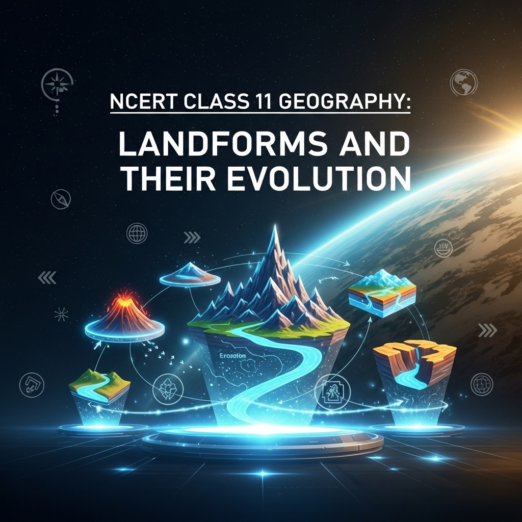
Landforms and Their Evolution
Chapter 6: Landforms - Ultimate Study Guide | NCERT Class 11 Notes, Questions, Examples & Quiz 2025
Full Chapter Summary & Detailed Notes - Landforms and Their Evolution Class 11 NCERT
Overview & Key Concepts
- Chapter Goal: Understand landforms evolution through geomorphic agents like running water, groundwater, glaciers, waves, winds. Exam Focus: Erosional/depositional landforms, stages (youth/mature/old), processes (erosion/deposition), karst topography, glacial features. 2025 Updates: Emphasis on climate change impacts on landforms, e.g., glacial retreat. Fun Fact: The Grand Canyon was carved by the Colorado River over millions of years. Core Idea: Landforms have histories—begin, evolve, change via slow/fast processes. Real-World: River deltas for agriculture; coastal erosion threats. Ties: To weathering (Ch5), physical features (Ch7+). Expanded: Agents act post-weathering; erosion/deposition alter earth's surface. Landscapes: Related landforms; evolution implies transformation stages akin to life (youth/mature/old). High relief reduction possible? Rarely complete due to uplift/tectonics.
- Wider Scope: Humid vs arid processes; overland/linear flow; karst in limestones.
- Expanded Content: Landforms: Small/medium earth's surface parcels; shape/size/material from agents/processes. Slow changes; climatic/tectonic influences. Youth: Steep gradients, erosion dominant; Mature: Lateral erosion; Old: Deposition, plains. Agents: Running water dominant humid; winds arid; glaciers high latitudes/altitudes.
Introduction & Landforms Basics
Post-weathering, agents (running water, groundwater, wind, glaciers, waves) erode/deposit, altering surface. Landforms: Small/medium tracts; landscapes: Related landforms. Each has shape/size/material from processes/agents; slow actions, long formation. Begin, evolve slowly/fast; climatic/tectonic changes modify. Evolution: Transformation stages, like life—youth (few streams, V-valleys), mature (many streams, wide valleys), old (meanders, plains). Expanded: Relief reduction? Not complete; uplift/erosion balance. Monadnocks: Resistant remnants. Peneplain: Almost plain from erosion.
- Examples: V-shaped valleys youth; floodplains mature; oxbow lakes old.
- Point: Two aspects: Transformation landform/individual; history development.
- Expanded: Geomorphic processes: Erosion/deposition; agents transport materials. Humid: Running water key; arid: Winds dominant.
Extended: Overland flow: Sheet erosion; concentrates to rills/gullies/valleys. Down-cutting youth; lateral mature; plains old.
Running Water
Humid regions: Heavy rainfall, dominant degradation agent. Components: Overland sheet, linear streams/valleys. Youth: Vigorous steep gradients, erosional landforms (valleys, potholes); few streams, V-valleys, waterfalls. Mature: Many streams, deep V-valleys, wide floodplains, meanders. Old: Few tributaries, gentle gradients, meanders, oxbow lakes, plains. Expanded: Gradient gentles via erosion; deposition increases. Overland: Sheet erosion to rills/gullies/valleys. Integration poor youth; good mature.
- Examples: Gorges (steep sides, equal width); canyons (wider top, step-slopes).
- Point: Relief reduction to peneplain; monadnocks remain.
- Expanded: Potholes: Circular depressions rocky beds; plunge pools at waterfalls. Incised meanders: Deep in hard rocks. Terraces: Old valley floors, paired/unpaired.
Extended: Depositional: Alluvial fans (cone-shaped, distributaries); deltas (sorted, stratified, distributaries lengthen); floodplains (active/inactive, levees, point bars); meanders (loops, cut-offs to oxbow).
Groundwater
Focus: Erosion/landforms, not resource. Percolates permeable/jointed rocks; horizontal flow erodes via solution/precipitation in limestones/dolomites. Karst: Typical landforms from solution/deposition; named after Balkans region. Expanded: Mechanical removal insignificant; chemical dominant in calcium-rich rocks. Swallow/sinkholes: Shallow depressions; collapse/solution types. Lapies: Ridges/grooves; pavements smooth.
- Examples: Uvalas (joined sinks); caves/tunnels (horizontal along beds).
- Point: Depositional: Stalactites (hang), stalagmites (rise), pillars (fuse).
- Expanded: Pools: Shallow water-covered sinks. Caves: Maze at elevations; openings discharge streams.
Extended: Karst: Erosional (pools/sinks/lapies/caves); depositional (stalactites/stalagmites/pillars). Solution: Carbonated water dissolves calcium.
Glaciers
Masses ice: Continental/piedmont (sheets), mountain/valley (linear). Slow movement gravity; erosion via friction/plucking/abrasion. Reduce mountains to hills/plains. Expanded: Cirques: Basin-like, tarn lakes. Horns: Sharp peaks from cirques; arêtes serrated ridges. Valleys: U-shaped, hanging, fjords (sea-filled).
- Examples: Matterhorn/Everest horns; Gangotri glacier.
- Point: Depositional: Till (unassorted); outwash (stratified).
- Expanded: Moraines: Terminal/lateral/medial/ground. Eskers: Sinuous ridges. Drumlins: Oval, stoss/tail. Outwash plains: Fans/gravel/sand/clay.
Extended: Erosion tremendous weight; debris damages rocks. Glacio-fluvial: Outwash.
Waves and Currents
Coastal: Dynamic/destructive; waves break/churn sediments. Storm/tsunami rapid changes. Coasts: High rocky (submerged, cliffs); low sedimentary (emerged, plains/deltas). Expanded: High: Indented, fjords, erosion dominant to platforms/terraces/beaches/bars/spits/lagoons. Low: Smooth, lagoons/creeks, deposition bars/spits.
- Examples: India west high/erosional; east low/depositional.
- Point: Cliffs/terraces/caves/stacks erosional; beaches/dunes/bars/spits depositional.
- Expanded: Waves: Constant pounding; configuration/sea level influence. Barriers: Buffer storms/tsunamis.
Extended: Generating: Winds/currents (ocean movements chapter). Beaches temporary; shingle pebbles/cobbles.
Winds
Deserts: Dominant agent; heated floors cause updrafts/turbulence. Deflation/abrasion/impact. Expanded: Pediments: Rocky floors mountain foot; extend via backwasting to pediplains/inselbergs. Playas: Shallow lakes/salt flats. Hollows/caves: Blown depressions. Mushroom/pedestal rocks: Worn shapes.
- Examples: Barchans (crescent); seifs (one wing); longitudinal/transverse dunes.
- Point: Sorting good; obstacles initiate dunes.
- Expanded: Mass wasting/sheet floods form features; rain removes weathered debris. Parabolic: Vegetated reversed barchans.
Extended: Winds destructive; sand blasting. Features owe to water too in deserts.
Summary
- Landforms evolve via agents/processes; stages youth/mature/old; erosional/depositional by water/ground/glaciers/waves/winds.
Why This Guide Stands Out
Complete: All subtopics, examples, Q&A, quiz. Geography-focused. Free 2025.
Key Themes & Tips
- Aspects: Erosion/deposition, stages, agents.
- Thinkers: None specific; processes key.
- Tip: Diagrams explain (Figs 6.1-6.14); compare humid/arid; karst unique.
Exam Case Studies
Himalayan glaciers, Ganga delta, Thar dunes.
Project & Group Ideas
- Model river meanders.
- Debate coastal erosion.


As an Amazon Associate, ProSyllabus earns from qualifying purchases. Prices shown are subject to change.
Test your CBSE Class 11 Annual Assessment prep
Quizzes
10 questions · ~10 minutes · instant rank & AI diagnosis
Accountancy (Class 11) Practice Quiz | CBSE Class 11 Annual Assessment
Sets and Venn Operations Fundamentals — Free CBSE Class 11 Annual Assessment Quiz
Class 11 English — The Tale of Melon City (Practice Quiz)
Class 11 English — Birth (Practice Quiz)
Class 11 English — Mother's Day (Practice Quiz)
Class 11 English — The Address (Practice Quiz)
Class 11 English — The Summer of the Beautiful White Horse (Practice Quiz)
Class 11 English — Father to Son (Practice Quiz)
Class 11 English — Silk Road (Practice Quiz)
Class 11 English — The Adventure (Practice Quiz)
Class 11 English — Childhood (Practice Quiz)
Class 11 English — The Ailing Planet: the Green Movement's Role (Practice Quiz)
Class 11 English — The Voice of the Rain (Practice Quiz)
Class 11 English — The Laburnum Top (Practice Quiz)
Class 11 English — Discovering Tut: the Saga Continues (Practice Quiz)
Class 11 English — We're Not Afraid to Die... if We Can All Be Together (Practice Quiz)
Class 11 English — A Photograph (Practice Quiz)
Class 11 English — The Portrait of a Lady (Practice Quiz)
Class 11 Psychology — Motivation and Emotion (Practice Quiz)
Class 11 Psychology — Thinking (Practice Quiz)
Class 11 Psychology — Human Memory (Practice Quiz)
Class 11 Psychology — Learning (Practice Quiz)
Class 11 Psychology — Sensory, Attentional and Perceptual Processes (Practice Quiz)
Class 11 Psychology — Human Development (Practice Quiz)
Class 11 Psychology — Methods of Enquiry in Psychology (Practice Quiz)
Class 11 Psychology — What is Psychology? (Practice Quiz)
Class 11 Sociology — Indian Sociologists (Practice Quiz)
Class 11 Sociology — Introducing Western Sociologists (Practice Quiz)
Class 11 Sociology — Environment and Society (Practice Quiz)
Class 11 Sociology — Social Change and Social Order in Rural and Urban Society (Practice Quiz)
Class 11 Sociology — Social Structure, Stratification and Social Processes in Society (Practice Quiz)
Class 11 Sociology — Doing Sociology: Research Methods (Practice Quiz)
Class 11 Sociology — Culture and Socialisation (Practice Quiz)
Class 11 Sociology — Understanding Social Institutions (Practice Quiz)
Class 11 Sociology — Terms, Concepts and Their Use in Sociology (Practice Quiz)
Class 11 Sociology — Sociology and Society (Practice Quiz)
Class 11 Political Science — The Philosophy of the Constitution (Practice Quiz)
Class 11 Political Science — Constitution as a Living Document (Practice Quiz)
Class 11 Political Science — Local Governments (Practice Quiz)
Class 11 Political Science — Federalism (Practice Quiz)
Class 11 Political Science — Judiciary (Practice Quiz)
Class 11 Political Science — Legislature (Practice Quiz)
Class 11 Political Science — Executive (Practice Quiz)
Class 11 Political Science — Election and Representation (Practice Quiz)
Class 11 Political Science — Rights in the Indian Constitution (Practice Quiz)
Class 11 Political Science — Constitution: Why and How? (Practice Quiz)
Class 11 Political Science — Secularism (Practice Quiz)
Class 11 Political Science — Nationalism (Practice Quiz)
Class 11 Political Science — Citizenship (Practice Quiz)
Class 11 Political Science — Rights (Practice Quiz)
Class 11 Political Science — Social Justice (Practice Quiz)
Class 11 Political Science — Equality (Practice Quiz)
Class 11 Political Science — Freedom (Practice Quiz)
Class 11 Political Science — Political Theory: An Introduction (Practice Quiz)
Class 11 Geography — Natural Hazards and Disasters (Practice Quiz)
Class 11 Geography — Natural Vegetation (Practice Quiz)
Class 11 Geography — Climate (Practice Quiz)
Class 11 Geography — Drainage System (Practice Quiz)
Class 11 Geography — Structure and Physiography (Practice Quiz)
Class 11 Geography — India – Location (Practice Quiz)
Class 11 Geography — Biodiversity and Conservation (Practice Quiz)
Class 11 Geography — Movements of Ocean Water (Practice Quiz)
Class 11 Geography — Water (Oceans) (Practice Quiz)
Class 11 Geography — World Climate and Climate Change (Practice Quiz)
Class 11 Geography — Water in the Atmosphere (Practice Quiz)
Class 11 Geography — Atmospheric Circulation and Weather Systems (Practice Quiz)
Class 11 Geography — Solar Radiation, Heat Balance and Temperature (Practice Quiz)
Class 11 Geography — Composition and Structure of Atmosphere (Practice Quiz)
Class 11 Geography — Landforms and their Evolution (Practice Quiz)
Class 11 Geography — Geomorphic Processes (Practice Quiz)
Class 11 Geography — Distribution of Oceans and Continents (Practice Quiz)
Class 11 Geography — Interior of the Earth (Practice Quiz)
Class 11 Geography — The Origin and Evolution of the Earth (Practice Quiz)
Class 11 Geography — Geography as a Discipline (Practice Quiz)
Class 11 History — Paths to Modernisation (Practice Quiz)
Class 11 History — Displacing Indigenous Peoples (Practice Quiz)
Class 11 History — Changing Cultural Traditions (Practice Quiz)
Class 11 History — The Three Orders (Practice Quiz)
Class 11 History — Nomadic Empires (Practice Quiz)
Class 11 History — An Empire Across Three Continents (Practice Quiz)
Class 11 History — Writing and City Life (Practice Quiz)
Class 11 Economics — Comparative Development Experiences of India and its Neighbours (Practice Quiz)
Class 11 Economics — Environment and Sustainable Development (Practice Quiz)
Class 11 Economics — Employment: Growth, Informalisation and Other Issues (Practice Quiz)
Class 11 Economics — Rural Development (Practice Quiz)
Class 11 Economics — Human Capital Formation in India (Practice Quiz)
Class 11 Economics — Liberalisation, Privatisation and Globalisation: An Appraisal (Practice Quiz)
Class 11 Economics — Indian Economy 1950-1990 (Practice Quiz)
Class 11 Economics — Indian Economy on the Eve of Independence (Practice Quiz)
Class 11 Economics — Use of Statistical Tools (Practice Quiz)
Class 11 Economics — Index Numbers (Practice Quiz)
Class 11 Economics — Correlation (Practice Quiz)
Class 11 Economics — Measures of Central Tendency (Practice Quiz)
Class 11 Economics — Presentation of Data (Practice Quiz)
Class 11 Economics — Organisation of Data (Practice Quiz)
Class 11 Economics — Collection of Data (Practice Quiz)
Class 11 Economics — Introduction (Practice Quiz)
Class 11 Business Studies — International Business (Practice Quiz)
Class 11 Business Studies — Internal Trade (Practice Quiz)
Class 11 Business Studies — MSME and Business Entrepreneurship (Practice Quiz)
Class 11 Business Studies — Sources of Business Finance (Practice Quiz)
Class 11 Business Studies — Formation of a Company (Practice Quiz)
Class 11 Business Studies — Social Responsibilities of Business and Business Ethics (Practice Quiz)
Class 11 Business Studies — Emerging Modes of Business (Practice Quiz)
Class 11 Business Studies — Business Services (Practice Quiz)
Class 11 Business Studies — Private, Public and Global Enterprises (Practice Quiz)
Class 11 Business Studies — Forms of Business Organisation (Practice Quiz)
Class 11 Business Studies — Business, Trade and Commerce (Practice Quiz)
Class 11 Accountancy — Financial Statements - II (Practice Quiz)
Class 11 Accountancy — Financial Statements - I (Practice Quiz)
Class 11 Accountancy — Depreciation, Provisions and Reserves (Practice Quiz)
Class 11 Accountancy — Trial Balance and Rectification of Errors (Practice Quiz)
Class 11 Accountancy — Bank Reconciliation Statement (Practice Quiz)
Class 11 Accountancy — Recording of Transactions - II (Practice Quiz)
Class 11 Accountancy — Recording of Transactions - I (Practice Quiz)
Class 11 Accountancy — Theory Base of Accounting (Practice Quiz)
Class 11 Accountancy — Introduction to Accounting (Practice Quiz)
Class 11 Maths — Probability (Practice Quiz)
Class 11 Maths — Statistics (Practice Quiz)
Class 11 Maths — Limits and Derivatives (Practice Quiz)
Class 11 Maths — Introduction to Three Dimensional Geometry (Practice Quiz)
Class 11 Maths — Conic Sections (Practice Quiz)
Class 11 Maths — Straight Lines (Practice Quiz)
Class 11 Maths — Sequences and Series (Practice Quiz)
Class 11 Maths — Binomial Theorem (Practice Quiz)
Class 11 Maths — Permutations and Combinations (Practice Quiz)
Class 11 Maths — Linear Inequalities (Practice Quiz)
Class 11 Maths — Complex Numbers and Quadratic Equations (Practice Quiz)
Class 11 Maths — Relations and Functions (Practice Quiz)
Class 11 Maths — Sets (Practice Quiz)
Class 11 Biology — Chemical Coordination and Integration (Practice Quiz)
Class 11 Biology — Neural Control and Coordination (Practice Quiz)
Class 11 Biology — Locomotion and Movement (Practice Quiz)
Class 11 Biology — Excretory Products and their Elimination (Practice Quiz)
Class 11 Biology — Body Fluids and Circulation (Practice Quiz)
Class 11 Biology — Breathing and Exchange of Gases (Practice Quiz)
Class 11 Biology — Plant Growth and Development (Practice Quiz)
Class 11 Biology — Respiration in Plants (Practice Quiz)
Class 11 Biology — Photosynthesis in Higher Plants (Practice Quiz)
Class 11 Biology — Cell Cycle and Cell Division (Practice Quiz)
Class 11 Biology — Biomolecules (Practice Quiz)
Class 11 Biology — Cell: The Unit of Life (Practice Quiz)
Class 11 Biology — Structural Organisation in Animals (Practice Quiz)
Class 11 Biology — Anatomy of Flowering Plants (Practice Quiz)
Class 11 Biology — Morphology of Flowering Plants (Practice Quiz)
Class 11 Biology — Animal Kingdom (Practice Quiz)
Class 11 Biology — Plant Kingdom (Practice Quiz)
Class 11 Biology — Biological Classification (Practice Quiz)
Class 11 Biology — The Living World (Practice Quiz)
Class 11 Chemistry — Hydrocarbons (Practice Quiz)
Class 11 Chemistry — Organic Chemistry – Some Basic Principles and Techniques (Practice Quiz)
Class 11 Chemistry — Redox Reactions (Practice Quiz)
Class 11 Chemistry — Equilibrium (Practice Quiz)
Class 11 Chemistry — Chemical Bonding and Molecular Structure (Practice Quiz)
Class 11 Chemistry — Classification of Elements and Periodicity in Properties (Practice Quiz)
Class 11 Chemistry — Some Basic Concepts of Chemistry (Practice Quiz)
Class 11 Physics — Waves (Practice Quiz)
Class 11 Physics — Oscillations (Practice Quiz)
Class 11 Physics — Kinetic Theory (Practice Quiz)
Class 11 Chemistry — Thermodynamics (Practice Quiz)
Class 11 Physics — Thermal Properties of Matter (Practice Quiz)
Class 11 Physics — Mechanical Properties of Fluids (Practice Quiz)
Class 11 Physics — Mechanical Properties of Solids (Practice Quiz)
Class 11 Physics — Gravitation (Practice Quiz)
Class 11 Physics — Systems of Particles and Rotational Motion (Practice Quiz)
Class 11 Physics — Work, Energy and Power (Practice Quiz)
Class 11 Physics — Motion in a Plane (Practice Quiz)
Class 11 Physics — Motion in a Straight Line (Practice Quiz)
Class 11 Physics — Units and Measurement (Practice Quiz)
Class 11 Maths — Trigonometric Functions (Practice Quiz)
Class 11 Chemistry — Structure of Atom (Practice Quiz)
Class 11 Physics — Laws of Motion (Practice Quiz)
Business Studies (Class 11) Practice Quiz | CBSE Class 11 Annual Assessment
Economics (Class 11) Practice Quiz | CBSE Class 11 Annual Assessment
Humanities Subjects Practice Quiz | CBSE Class 11 Annual Assessment
Motion in a Straight Line Practice Quiz | CBSE Class 11 Annual Assessment
Thermodynamic Processes and Laws Advanced Challenge | CBSE Class 11 Annual Assessment

Group Discussions
No forum posts available.

