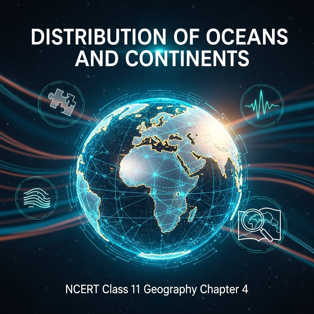
Full Chapter Summary & Detailed Notes - Distribution of Oceans and Continents Class 11 NCERT
Overview & Key Concepts
- Chapter Goal: Understand the distribution and movement of continents and oceans through theories like continental drift and plate tectonics. Exam Focus: Wegener's theory, evidence (jig-saw fit, fossils), sea floor spreading, plate boundaries, Indian plate movement, ocean floor features. 2025 Updates: Emphasis on modern mapping techniques and seismic data. Fun Fact: Pangaea means 'all earth' in Greek, proposed by Wegener in 1912. Core Idea: Continents and oceans are dynamic, driven by internal forces. Real-World: Predicting earthquakes via plate movements. Ties: To chapters on earth's interior, landforms, and ocean relief. Expanded: Detailed analysis of post-WWII discoveries like mid-ocean ridges and magnetic stripes, which revolutionized geology. Additional: Role of convection currents in mantle, rates of plate movement (2.5-15 cm/yr), and implications for natural disasters.
- Wider Scope: Explains global features like Himalayas from plate collisions, ocean trenches from subduction, and volcanic arcs. Sustainability angle: Resource distribution in oceans, climate change impacts on sea levels.
- Expanded Content: Theories evolved from early ideas (Ortelius 1596) to modern plate tectonics (1967). Integrates geology, paleontology, and geophysics for a comprehensive view of earth's history over 540 million years.
Introduction
Continents cover 29% of earth's surface, oceans 71%. Positions not static; changed in past, will change in future. Questions: Past positions? How determined? Why/how change? Scientists use evidence like coastline symmetry. Expanded: World map shows Atlantic coastlines fitting like puzzle. Historical context: Ortelius (1596), Pellegrini maps, Wegener's comprehensive theory (1912) on distribution.
- Examples: Symmetry of Africa/South America coasts. Depth: Computer fits at 1,000-fathom line confirm match.
- Point: Dynamic earth; continents/oceans mobile over geological time.
- Expanded: Implications for resource exploration, disaster prediction. Additional: Paleoclimates and fossil distributions indicate past connections.
Extended: Supercontinent Pangaea surrounded by Panthalassa; split ~200 mya into Laurasia (north) and Gondwanaland (south), further fragmenting into modern continents.
Continental Drift
Wegener proposed all continents as single mass Pangaea, surrounded by Panthalassa. Split ~200 mya; Laurasia north, Gondwanaland south. Evidence provided. Expanded: Theory from coastline observations; influenced by earlier ideas. Detailed: Pangaea breakup sequence, formation of modern oceans like Atlantic.
- Examples: Americas, Europe, Africa once joined. Depth: Argument based on geological similarities across oceans.
- Point: Explains current distribution; supported by multiple evidences.
- Expanded: Criticisms: Inadequate forces; later validated by new data. Additional: Role in understanding biodiversity evolution.
Extended: Wegener, meteorologist, used interdisciplinary data; theory revived post-WWII with ocean floor mapping.
Evidence for Continental Drift
Jig-saw fit: Africa/South America match at 1,000-fathom. Rocks same age: 2,000 mya Brazil-Africa; Jurassic marine deposits. Tillite: Gondwana glaciation counterparts in multiple lands. Placer deposits: Ghana gold from Brazil. Fossils: Identical species across oceans (Lemurs, Mesosaurus). Expanded: Radiometric dating correlates formations; paleoclimates from tillite. Detailed: Fossils indicate land connections before marine barriers.
- Examples: Mesosaurus skeletons only in South Africa/Brazil, 4,800 km apart. Depth: Unambiguous proof of drifting.
- Point: Variety of geological, paleontological evidence supports theory.
- Expanded: Overall resemblance in Gondwana sediments shows similar histories. Additional: Problems in accounting for fossil distribution without drift.
Extended: Evidence mostly from continental areas; post-drift from oceans added dimensions.
Force for Drifting
Wegener: Pole-fleeing (earth rotation bulge) and tidal (moon/sun attraction). Effective over millions years; scholars deemed inadequate. Expanded: Polar-fleeing relates to equator bulge; tidal to ocean tides. Detailed: Forces too weak for massive movements; led to theory discard initially.
- Examples: Earth not perfect sphere due to rotation. Depth: Tides develop in waters; applied to continents over time.
- Point: Attempt to explain mechanism; insufficient led to alternatives like convection.
- Expanded: Post-theory, Holmes proposed mantle convection from radioactive heat. Additional: Modern view: Convection cells drive plates.
Extended: Shift from surface forces to internal dynamics.
Post-Drift Studies
Convectional currents (Holmes 1930s): Radioactive heat in mantle generates currents. Ocean floor mapping: Relief like ridges, trenches; young crust. Expanded: Post-WWII expeditions revealed active mid-ocean ridges, shallow EQ. Detailed: Rocks similar age/composition on ridge sides; sediments thin, <200 mya old.
- Examples: Mid-ocean ridges volcanic; trenches deep EQ. Depth: Crust younger than continents (max 200 mya vs 3,200 mya).
- Point: New data revived drift interest; led to sea floor spreading.
- Expanded: Ocean floor divisions: Margins (shelf/slope/rise/trenches), abyssal plains, mid-ocean ridges. Additional: EQ/volcano distribution aligns with ridges/Alpine-Himalayan/Pacific rim.
Extended: Convection system throughout mantle; explains force issue.
Ocean Floor Configuration
Divisions: Margins (transition shores-basins; trenches interest), abyssal plains (sediments), mid-ocean ridges (chain, rift, volcanic). Expanded: Ridges interconnected; central rift intense activity. Detailed: Plains between margins-ridges; trenches near margins.
- Examples: Mid-Atlantic Ridge. Depth: Relief not plain; submerged mountains, deep trenches.
- Point: Helps understand distribution; active zones.
- Expanded: EQ shallow at ridges, deep at trenches/Pacific rim ('ring of fire'). Additional: Maps show dots along ridges, shaded Alpine-Himalayan/Pacific.
Extended: Ties to spreading/subduction.
Concept of Sea Floor Spreading
Hess (1961): Eruptions at ridges rupture crust; lava pushes sides. Ocean spreads; consumed at trenches. Expanded: Normal polarity young rocks; age increases from crest. Detailed: Sediments thin; EQ depths vary.
- Examples: Magnetic similarities on sides. Depth: No shrinking as new crust forms.
- Point: Explains young ocean crust; constant size.
- Expanded: Paleomagnetic studies confirm. Additional: Consumption maintains balance.
Extended: Depicted in Fig 4.3; led to plate tectonics.
Plate Tectonics
McKenzie/Parker/Morgan (1967): Lithosphere divided into plates (continental/oceanic). 7 major: Antarctica, N/S American, Pacific, India-Australia-NZ, Africa, Eurasia. Boundaries: Divergent (spreading), convergent (subduction), transform (slide). Expanded: Plates 5-200 km thick; move over asthenosphere. Detailed: Minor plates like Cocos, Nazca.
- Examples: Mid-Atlantic divergent; Himalayas convergent. Depth: Surrounded by ridges/trenches/faults.
- Point: Plates move; continents part of plates.
- Expanded: Rates from magnetic stripes: Arctic slow, E Pacific fast. Additional: Forces convection cells from radioactive/residual heat.
Extended: Pangaea from converging plates; positions traced via paleomagnetism (Fig 4.4).
Movement of the Indian Plate
Includes Peninsula/Australia. Boundaries: N subduction Himalayas, E spreading SW Pacific, W Kirthar/Makrana, S oceanic ridge. Started ~200 mya from Australia; collided Asia ~40-50 mya uplifting Himalayas. Expanded: Tethys separated from Asia ~225 mya; Deccan Traps ~60 mya lava. Detailed: Positions ~71 mya to present (Fig 4.6); still rising.
- Examples: ~50°S 140 mya; equator during Traps. Depth: Outpouring during movement.
- Point: Explains Indian features like Himalayas, Deccan.
- Expanded: Tibetan block near Asia; process continues. Additional: Northward journey ~200 mya post-Pangaea break.
Extended: Implications for seismicity in region.
Summary
- Theories explain dynamic continents/oceans; drift to tectonics; evidence geological/paleontological; forces internal; Indian plate key example.
Why This Guide Stands Out
Complete: All subtopics, examples, Q&A, quiz. Geography-focused. Free 2025.
Key Themes & Tips
- Aspects: Dynamic, evidence-based, interdisciplinary.
- Thinkers: Wegener, Hess, Holmes, McKenzie.
- Tip: Diagrams key (Figs 4.1-4.6); boundaries classify; movements trace; evidence link.
Exam Case Studies
Himalayas formation, Atlantic opening, EQ distribution.
Project & Group Ideas
- Model Pangaea breakup.
- Debate drift vs tectonics.
- Map plate boundaries and disasters.
60+ Questions & Answers - NCERT Based (Class 11)
Part A (1 mark short), B (4 marks medium), C (8 marks long). Based on NCERT, exercises. Answer lengths: 1 mark ~2 lines, 4 marks ~5 lines, 8 marks ~10 lines.
Part A: 1 Mark Questions
1. Who first proposed continental drift?
1 Mark Answer: Abraham Ortelius in 1596; comprehensively by Alfred Wegener in 1912. Theory on ocean/continent distribution.
2. What is Pangaea?
1 Mark Answer: Supercontinent ~200 mya; all lands joined. Surrounded by Panthalassa mega-ocean.
3. Name northern Pangaea component.
1 Mark Answer: Laurasia; formed N America, Eurasia. Southern was Gondwanaland.
4. What is jig-saw fit?
1 Mark Answer: Matching coastlines like puzzle. Ex: Africa/S America at 1,000-fathom line.
5. Define tillite.
1 Mark Answer: Glacial sedimentary rock. Evidence of Gondwana glaciation across lands.
6. What are placer deposits?
1 Mark Answer: Mineral accumulations like gold. Ghana from Brazil plateau past.
7. Name a drift force by Wegener.
1 Mark Answer: Pole-fleeing; due to earth rotation bulge. Tidal from moon/sun.
8. Who proposed convection currents?
1 Mark Answer: Arthur Holmes in 1930s. Radioactive heat in mantle.
9. What is mid-oceanic ridge?
1 Mark Answer: Submerged mountain chain; central rift volcanic. Interconnected system.
10. Define abyssal plains.
1 Mark Answer: Flat areas between margins/ridges. Continental sediment deposits.
11. What is ring of fire?
1 Mark Answer: Pacific rim active volcanoes. Deep EQ concentration.
12. Who proposed sea floor spreading?
1 Mark Answer: Harry Hess in 1961. Eruptions push crust apart.
13. Define subduction zone.
1 Mark Answer: Sinking plate at convergent. Crust destroyed; trenches.
14. Name a major plate.
1 Mark Answer: Pacific plate; largely oceanic. Eurasia continental.
15. What is divergent boundary?
1 Mark Answer: Plates pull apart; new crust. Ex: Mid-Atlantic Ridge.
16. Define transform boundary.
1 Mark Answer: Plates slide past; no create/destroy. Faults perpendicular ridges.
17. What is slowest plate rate?
1 Mark Answer: Arctic Ridge <2.5 cm/yr. East Pacific Rise fastest >15 cm/yr.
18. Name Indian plate northern boundary.
1 Mark Answer: Himalayas subduction; continent-continent convergence. East island arc Java Trench.
19. What is Tethys Sea?
1 Mark Answer: Separated India-Asia ~225 mya. Closed by collision ~40-50 mya.
20. When were Deccan Traps formed?
1 Mark Answer: ~60 mya lava outpouring. During Indian movement near equator.
21. What is Lemuria?
1 Mark Answer: Hypothetical land linking India/Madagascar/Africa. For lemur distribution.
22. Define paleomagnetism.
1 Mark Answer: Study ancient magnetic fields in rocks. Determines past positions/rates.
Part B: 4 Marks Questions
1. Explain Wegener's continental drift theory.
4 Marks Answer: All continents single mass Pangaea ~200 mya, surrounded Panthalassa. Split into Laurasia north, Gondwanaland south; further into modern. Evidence like coastline match, same age rocks. Forces pole-fleeing/tidal; inadequate per scholars.
2. Describe jig-saw fit evidence.
4 Marks Answer: Africa/S America shorelines match remarkably. Bullard 1964 computer program best fit Atlantic margin at 1,000-fathom not shoreline. Proved perfect; suggests once joined. Symmetry Atlantic coasts surprised scientists.
3. Explain tillite evidence.
4 Marks Answer: Glacial sedimentary from Gondwana system. Thick tillite base indicates prolonged glaciation. Counterparts Africa/Falkland/Madagascar/Antarctica/Australia/India. Resemblance demonstrates similar histories; paleoclimate/drift proof.
4. Describe placer deposits evidence.
4 Marks Answer: Rich gold Ghana coast; no local source rock. Veins Brazil; deposits derived plateau when side by side. Amazing fact supports past connection. Obvious derivation across ocean.
5. Explain fossil distribution evidence.
4 Marks Answer: Identical land/fresh water species across marine barriers. Lemurs India/Madagascar/Africa suggest Lemuria. Mesosaurus skeletons only S Africa/Brazil; 4,800 km apart ocean between. Accounts for distribution problem.
6. Describe forces for drifting by Wegener.
4 Marks Answer: Pole-fleeing from rotation bulge equator. Tidal from moon/sun attraction tides. Effective over millions years. Scholars considered inadequate. Related earth not perfect sphere.
7. Explain convectional current theory.
4 Marks Answer: Holmes 1930s; currents mantle from radioactive thermal differences. System entire mantle. Explained force issue; discarded drift revived. Generated heat causes rise/cool/sink.
8. Describe ocean floor mapping findings.
4 Marks Answer: Post-WWII; relief ridges/trenches near margins. Ridges volcanic active; rocks young <200 mya. Similar constituents/age equidistant crest sides. Sediments thin.
9. Explain abyssal plains.
4 Marks Answer: Extensive plains margins-ridges. Continental sediments deposited beyond margins. Part ocean floor divisions based depth/relief. Lie deep-sea basins.
10. Describe mid-oceanic ridges.
4 Marks Answer: Interconnected mountain chain ocean. Central rift crest; fractionated plateau/flank. Intense volcanic activity rift. Longest surface chain submerged.
11. Explain EQ/volcano distribution.
4 Marks Answer: Dots central Atlantic parallel coasts extend Indian; coincide ridges. Shaded Alpine-Himalayan/Pacific rim. Shallow foci ridges; deep Alpine/Pacific. Pacific rim fire active volcanoes.
12. Describe sea floor spreading concept.
4 Marks Answer: Hess 1961; eruptions ridges rupture crust; lava wedges push sides. Spreads ocean; young rocks normal polarity crest. Age increases away; consumed trenches.
13. Explain plate tectonics.
4 Marks Answer: 1967 McKenzie/Parker/Morgan; lithosphere 7 major/minor plates. Move horizontally asthenosphere. Continental/oceanic; surrounded ridges/trenches/faults. Plates rigid units.
14. Name major plates.
4 Marks Answer: Antarctica/surrounding oceanic; N American (W Atlantic); S American (W Atlantic); Pacific; India-Australia-NZ; Africa (E Atlantic); Eurasia/adjacent oceanic. Minor: Cocos/Nazca/Arabian etc.
15. Describe divergent boundaries.
4 Marks Answer: Plates pull away; new crust generated. Spreading sites; e.g., Mid-Atlantic Ridge. American from Eurasian/African. Pull apart create rifts.
16. Explain convergent boundaries.
4 Marks Answer: Crust destroyed; one dives under (subduction). Ways: Oceanic-continental; two oceanic; two continental. Location sinking subduction zone.
17. Describe transform boundaries.
4 Marks Answer: No produce/destroy; slide horizontally past. Faults perpendicular ridges. Differential movement portions; earth rotation effect.
18. Explain plate movement rates.
4 Marks Answer: From magnetic stripes parallel ridges. Vary; Arctic <2.5 cm/yr slowest; E Pacific >15 cm/yr fastest. Help determine movement.
19. Describe force for plate movement.
4 Marks Answer: Convection cells mantle; heated material rises/spreads/cools/sinks. Heat radioactive decay/residual. Holmes 1930s; influenced Hess spreading.
20. Explain Indian plate movement.
4 Marks Answer: Island off Australia ~225 mya; Tethys separated Asia. Northward ~200 mya post-Pangaea. Collided ~40-50 mya uplift Himalayas. Deccan Traps ~60 mya; still rising.
21. What is Mesosaurus evidence?
4 Marks Answer: Small reptile shallow brackish. Skeletons only S Africa/Brazil; 4,800 km apart ocean. Indicates land connection past. Adapted non-marine.
22. Describe rocks same age evidence.
4 Marks Answer: Radiometric dating correlates formations continents. 2,000 mya Brazil-W Africa; Jurassic marine S America/Africa. Suggests ocean not prior Jurassic.
Part C: 8 Marks Questions
1. Discuss evidences in support of continental drift theory.
8 Marks Answer: Jig-saw fit: Africa/S America match; Bullard 1964 computer perfect at 1,000-fathom. Rocks same age: 2,000 mya Brazil-Africa; Jurassic marine deposits suggest ocean post-that. Tillite: Gondwana glacial sediments counterparts Africa/Falkland/Madagascar/Antarctica/Australia/India; resemblance histories paleoclimate/drift. Placer: Ghana gold no local source; from Brazil veins when adjacent. Fossils: Identical land/fresh species across oceans; Lemurs India/Madagascar/Africa suggest Lemuria; Mesosaurus S Africa/Brazil only, 4,800 km apart. Variety geological/paleontological from continental areas. Post-drift ocean data added. Unambiguous proof drifting.
2. Bring about basic difference between drift theory and plate tectonics.
8 Marks Answer: Drift: Wegener 1912; continents move through oceans; Pangaea split; forces pole-fleeing/tidal inadequate. Focused continents; evidence fits/fossils/rocks. Discarded initially. Tectonics: 1967 McKenzie/Morgan; lithosphere plates (continent/ocean) move over asthenosphere; boundaries divergent/convergent/transform. Unified spreading/subduction; forces convection cells. Plates not just continents; constant movement geological history. Pangaea result converging plates not initial. Explains EQ/volcanoes/ocean relief. Revived drift with new data; more comprehensive mechanism. Differences: Scope (continents vs plates), forces, boundaries.
3. What were major post-drift discoveries rejuvenating interest in oceans/continents distribution?
8 Marks Answer: Convection currents Holmes 1930s: Mantle radioactive thermal differences generate flows; explained force. Ocean mapping post-WWII: Relief ridges/trenches; ridges volcanic active; rocks young <200 mya continents 3,200 mya. Similar age/composition equidistant crest; normal polarity young. Sediments thin unexpected old floors. EQ shallow ridges deep trenches. Paleomagnetic: Magnetic properties rocks sides ridge; stripes normal/reverse. Revived interest; led Hess spreading 1961: Eruptions rupture push crust; consumed trenches. No shrinking; young crust. Detailed analysis magnetic led hypothesis.
4. Explain ocean floor configuration and its divisions.
8 Marks Answer: Not vast plain; relief mountains/trenches. Divisions depth/relief: Continental margins transition shores-basins; shelf/slope/rise/trenches (deep interest distribution). Abyssal plains extensive between margins-ridges; continental sediments beyond. Mid-oceanic ridges interconnected chain; central rift volcanic intense; fractionated plateau/flank. Longest submerged chain. Mapping post-WWII detailed picture; ridges active eruptions. Trenches near margins; ridges central. Helps understand oceans/continents; active zones EQ/volcanoes.
5. Discuss distribution of earthquakes and volcanoes.
8 Marks Answer: Maps show dots central Atlantic parallel coasts extend Indian; bifurcates S India E Africa/Myanmar-New Guinea. Coincides mid-oceanic ridges. Shaded another concentration Alpine-Himalayan/Pacific rim. Foci shallow ridges; deep Alpine/Pacific. Volcanoes similar; Pacific rim fire active. General shallow mid-ocean; deep convergent. Ties to boundaries: Divergent ridges shallow; convergent deep. Explains ring fire. Distribution evidence tectonics; active zones.
6. Explain concept of sea floor spreading with facts.
8 Marks Answer: Hess 1961 hypothesis: Eruptions mid-oceanic ridges common; lava surface. Rocks equidistant crest similar formation/composition/magnetic. Closer crest normal polarity youngest; age increases away. Ocean crust <200 mya; continents 3,200 mya. Sediments thin; not older 200 mya if old as continents. Trenches deep EQ; ridges shallow. Constant eruptions rupture; lava wedges push sides; floor spreads. Pushed sinks trenches consumed. No shrinking; maintains size. Depicted Fig 4.3.
7. Describe plate tectonics theory and major plates.
8 Marks Answer: 1967 McKenzie/Parker/Morgan; lithosphere divided plates massive irregular solid rock continental/oceanic. Thickness 5-100 km oceanic 200 km continental. Move horizontally asthenosphere rigid units. Continental or oceanic depending larger portion; Pacific oceanic Eurasian continental. 7 major: Antarctica/oceanic; N American W Atlantic Caribbean; S American W Atlantic Caribbean; Pacific; India-Australia-NZ; Africa E Atlantic; Eurasia adjacent oceanic. Minor: Cocos Central America-Pacific; Nazca S America-Pacific; Arabian Saudi; Philippine Asiatic-Pacific; Caroline Philippine-Indian N New Guinea. Surrounded young fold mountains/ridges/trenches/faults.
8. Explain types of plate boundaries.
8 Marks Answer: Divergent: New crust as pull away; spreading sites e.g. Mid-Atlantic American from Eurasian/African. Convergent: Crust destroyed one dives under; subduction zone. Ways: Oceanic-continental; two oceanic; two continental. Transform: Neither produce/destroy; slide horizontally past. Faults perpendicular mid-oceanic ridges. Differential movement portions away axis; rotation effect separated blocks. Boundaries key movements; explain features like ridges (divergent) trenches (convergent) faults (transform).
9. Discuss rates and force for plate movement.
8 Marks Answer: Rates from normal/reverse magnetic stripes parallel mid-oceanic ridges. Vary considerably; Arctic slowest <2.5 cm/yr; East Pacific Rise fastest >15 cm/yr near Easter Island. Determined scientists using paleomagnetic data. Force: Mobile rock beneath rigid plates circular manner. Heated material rises spreads cools sinks; cycle convection cell. Heat radioactive decay/residual. Holmes 1930s considered; influenced Hess spreading. Earth surface/interior dynamic not static motionless. Unified tectonics emphasized.
10. Explain movement of the Indian plate.
8 Marks Answer: Includes Peninsula Australian portions. N boundary subduction Himalayas continent-continent convergence. E extends Rakinyoma Myanmar island arc Java Trench; spreading E Australia oceanic ridge SW Pacific. W follows Kirthar Pakistan extends Makrana coast joins Red Sea rift SE Chagos Archipelago. Boundary Antarctica divergent oceanic ridge W-E merging S New Zealand. Large island off Australia vast ocean; Tethys separated Asia ~225 mya. Northward ~200 mya Pangaea break; collided Asia ~40-50 mya rapid Himalayas uplift. Positions ~71 mya present Fig 4.6; ~140 mya 50°S; Tibetan closer Asiatic. Deccan Traps ~60 mya outpouring; subcontinent equator. Process continuing; height rising.
11. Analyze post-drift studies role in theory revival.
8 Marks Answer: Drift evidence continental; post-WWII ocean floor mapping new dimensions. Convection Holmes 1930s mantle currents radioactive. Ocean configuration ridges/trenches near margins; ridges active volcanic. Rocks younger continents; similar equidistant crest. Sediments thin <200 mya. Trenches deep EQ ridges shallow. Paleomagnetic rocks sides ridge similarities period/composition/properties; normal young age increases away. Facts analysis led Hess spreading 1961. Constant eruptions rupture lava wedges push; spreads. Consumption oceanic crust trenches. Revived interest problem distribution.
12. Examine evolution from drift to tectonics.
8 Marks Answer: Ortelius 1596 possibility; Pellegrini map; Wegener 1912 comprehensive drift Pangaea split forces inadequate. Discarded; post-drift studies revived. Holmes convection; ocean mapping young crust magnetic stripes. Hess spreading 1961 eruptions push consumption trenches. McKenzie/Parker/Morgan 1967 tectonics plates move asthenosphere boundaries types. Not continents move plates; all moved past future. Pangaea converging masses parts plates. Paleomagnetic positions different periods Fig 4.4. Indian Nagpur rocks traced. Unified explains features disasters.
13. Discuss importance of ocean floor configuration.
8 Marks Answer: Segmented three divisions depth relief: Margins shelf/slope/rise/trenches transition shores-basins; trenches considerable interest distribution. Abyssal plains extensive margins-ridges; sediments beyond. Mid-oceanic ridges chain mountain system ocean; central rift volcanic; fractionated plateau flank. Helps understanding continents oceans. Ridges spreading sites new crust; trenches subduction destroy. Ties EQ/volcanoes: Shallow ridges deep trenches/Pacific rim fire. Post-WWII expeditions detailed; indicated submerged ranges deep trenches closer margins.
14. Analyze evidences from fossils and rocks.
8 Marks Answer: Fossils: Identical adapted land/fresh across marine; problem distribution. Lemurs India/Madagascar/Africa contiguous Lemuria. Mesosaurus shallow brackish; skeletons only S Africa/Brazil 4,800 km ocean. Rocks: Radiometric correlates different continents. Belt 2,000 mya Brazil W Africa. Earliest marine Jurassic S America/Africa; ocean not prior. Supports drift; once joined. Additional tillite glacial counterparts multiple S Hemisphere; resemblance Gondwana sediments histories. Unambiguous paleoclimates drifting.
15. Examine forces evolution in theories.
8 Marks Answer: Wegener pole-fleeing rotation bulge; tidal moon/sun tides; over millions effective inadequate. Holmes 1930s convection mantle radioactive thermal; system entire portion explanation force. Post-drift emphasized dynamic interior. Modern convection cells: Heated rises spreads cools sinks cycle repeated. Sources radioactive decay residual heat. Influenced Hess spreading unified tectonics. Rigid plates over soft asthenosphere; mobile rock circular. Driving behind movement. Shift surface internal forces.
16. Discuss Indian plate boundaries and movement.
8 Marks Answer: N subduction Himalayas continent-continent. E Rakinyoma Myanmar arc Java Trench. E margin spreading oceanic ridge SW Pacific E Australia. W Kirthar Pakistan Makrana coast joins Red Sea rift SE Chagos. S boundary Antarctica divergent oceanic ridge W-E merges S New Zealand. Island off Australia; Tethys separated Asia ~225 mya. Northward ~200 mya Pangaea break. ~140 mya 50°S; two plates Tethys Tibetan Asiatic. Deccan Traps ~60 mya lava; near equator. Collided ~40-50 mya Himalayas uplift. Process continues height rising.
17. Analyze sea floor spreading evidences.
8 Marks Answer: Volcanic eruptions common ridges lava surface. Rocks equidistant sides crest similar period chemical magnetic. Closer ridges normal polarity youngest; age increases away. Ocean crust younger continents nowhere >200 mya; some continental 3,200 mya. Sediments unexpectedly thin; if old as continents complete sequence longer duration; column not older 200 mya. Trenches deep-seated EQ ridges shallow. Facts detailed magnetic properties sides ridge led Hess hypothesis. Constant eruptions rupture new lava wedges push sides; spreads.
18. Examine plate movement implications.
8 Marks Answer: Plates constantly moving globe history; continue future. Not continent moves plate. All plates moved geological past. Pangaea result converging different masses parts plates. Scientists paleomagnetic data determined positions present landmasses periods Fig 4.4. Indian subcontinent (Peninsular) traced Nagpur rocks. Implications: Formations like Himalayas collision; EQ/volcanoes boundaries; ocean opening spreading. Rates vary Arctic slow E Pacific fast. Forces convection cells heat sources. Dynamic earth surface interior.
19. Discuss project work relevance.
8 Marks Answer: Prepare collage damages caused earthquake. Ties distribution EQ/volcanoes chapter; boundaries convergent/transform. Real-world application tectonics; ring fire examples. Enhances understanding impacts movements. Group: Collect images recent quakes like Nepal/Japan; link plates involved. Demonstrates practical relevance theory disasters. Additional: Discuss mitigation plate knowledge.
20. Analyze historical development of theories.
8 Marks Answer: Ortelius 1596 possibility Americas/Europe/Africa joined. Pellegrini map three together. Wegener 1912 comprehensive drift Pangaea Panthalassa split Laurasia/Gondwanaland. Evidence fits/rocks/tillite/placer/fossils. Forces pole/tidal inadequate. Holmes 1930s convection mantle. Post-WWII ocean mapping young crust magnetic led Hess 1961 spreading eruptions push consumption. McKenzie/Parker/Morgan 1967 tectonics plates boundaries. Unified; revived drift new dimensions. Positions paleomagnetic; Indian example.
21. Explain convection as force with Holmes idea.
8 Marks Answer: Holmes 1930s possibility currents mantle. Generated radioactive elements thermal differences. System entire mantle. Explanation force contemporary discarded drift. Later influenced Hess spreading unified tectonics. Mobile rock beneath rigid plates circular. Heated rises surface spreads cools sinks deeper. Cycle repeated generate convection cell/flow. Heat two sources: Radioactive decay residual. Earth not solid motionless body dynamic surface interior. Emphasized both not static.
22. Discuss Indian plate positions through time.
8 Marks Answer: ~225 mya large island off Australia Tethys separated Asia. Started northward ~200 mya Pangaea break. ~140 mya as south 50°S; two major plates separated Tethys Tibetan closer Asiatic. During movement major event Deccan Traps lava outpouring started ~60 mya continued long; subcontinent still close equator. From ~40 mya Himalayas formation took place collision Asia ~40-50 mya rapid uplift. Positions since ~71 mya present shown Fig 4.6 also Indian subcontinent Eurasian plate. Scientists believe process continuing height Himalayas rising even date.
Tip: Evidences link examples; theories compare; diagrams describe; movements trace.
Post-Drift Studies - Detailed Guide
Convection, mapping (expanded).
Convection
Mantle currents. Deriv: Holmes. Ex: Thermal. Depth: Radioactive. Expanded: Entire system.
Mapping
Ocean relief. Deriv: Post-WWII. Ex: Ridges active. Depth: Young rocks. Expanded: Similar sides.
Findings
Sediments thin. Deriv: EQ depths. Ex: Volcanic. Depth: Added dimensions. Expanded: Revived interest.
Tip: Data new. Depth: Force explain. Examples: Expeditions. Graphs: 4.1/4.2. Advanced: Paleomagnetic.
Principles: Revival. Errors: Continental only. Real: Tech advances.
Extended: Relief detail. Numerical: Ages.