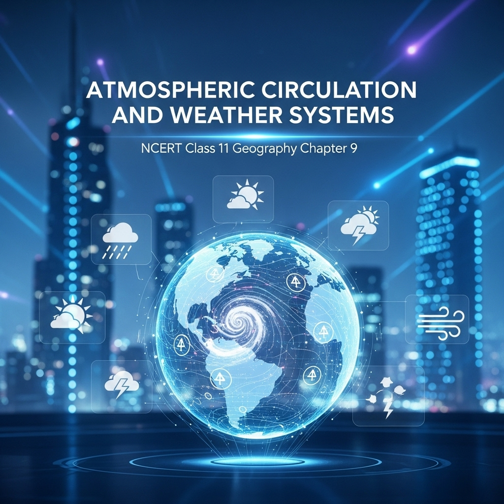
Full Chapter Summary & Detailed Notes - Atmospheric Circulation and Weather Systems Class 11 NCERT
Overview & Key Concepts
- Chapter Goal: Understand atmospheric pressure variations, wind systems, circulation patterns, air masses, fronts, and weather phenomena like cyclones. Exam Focus: Pressure systems, forces on winds, general circulation, El Nino/ENSO, local winds, air masses classification, fronts types, extra/tropical cyclones, thunderstorms/tornadoes. 2025 Updates: Emphasis on climate change impacts on circulation, real-time monitoring via satellites. Fun Fact: Coriolis force named after Gaspard-Gustave Coriolis (1835); deflects winds right in NH, left in SH. Core Idea: Winds redistribute heat/moisture, maintain planetary temperature. Real-World: Monsoons in India; El Nino droughts/floods. Ties: To previous chapters on temperature distribution; subsequent on water cycles/climates.
- Wider Scope: Turbulent winds, air masses interactions, violent storms, global heat balance, ocean-atmosphere links.
- Expanded Content: Chapter explains pressure differences cause air motion (winds), vertical/horizontal variations, forces controlling velocity/direction. Discusses global patterns like trade winds, westerlies, polar easterlies; seasonal shifts (monsoons); local breezes; air masses from source regions; fronts leading to precipitation; cyclones formation/destruction. Includes ENSO phenomena for long-range forecasting. Practical: Use barometers; analyze weather maps for isobars/winds.
Atmospheric Pressure
Weight of air column per unit area from sea level to atmosphere top; measured in millibars (mb), average 1013.2 mb at sea level. Denser at surface due to gravity; decreases with height (1 mb per 10m rise). Instruments: Mercury/aneroid barometer (refer Practical Work in Geography Part I). Vertical: Rapid decrease lower atmosphere; balanced by gravity, no strong upward winds. Table 9.1: Sea level 1013.25 mb/15.2°C; 1km 898.76 mb/8.7°C; 5km 540.48 mb/-17.3°C; 10km 265 mb/-49.7°C. Horizontal: Small differences significant for wind; isobars connect equal pressure, reduced to sea level for maps. Low-pressure: Enclosed by isobars, lowest center; high-pressure: Highest center. World: Equatorial low near equator; subtropical highs 30°N/S; subpolar lows 60°N/S; polar highs near poles. Oscillate with sun's path; NH winter southwards, summer northwards. Figures 9.2/9.3 show January/July distributions.
- Examples: Sea level adjustments eliminate altitude effects; isobars close = strong gradient/winds.
- Point: Pressure variations drive air motion from high to low.
- Expanded: Pressure gradient: Change rate with distance; strong where isobars close. Affects wind velocity/direction; key for weather prediction. Real: Low pressure over heated land causes monsoons. Ties: To temperature unevenness from Chapter 8.
Extended: Body experiences pressure; rarified air at heights causes breathlessness. Variations primary cause of winds; redistribute heat/moisture globally.
Forces Affecting Velocity and Direction of Wind
Air motion due to pressure differences; wind from high to low. Surface friction; earth's rotation (Coriolis); gravity downward. Pressure gradient: Produces force; strong close isobars. Frictional: Greatest surface, extends 1-3km; minimal over sea. Coriolis: Deflects right NH, left SH; proportional to velocity/latitude (max poles, zero equator). Perpendicular to gradient; results in geostrophic wind parallel to isobars upper atmosphere. Cyclonic: Around low, anticlockwise NH/clockwise SH. Anticyclonic: Around high, clockwise NH/anticlockwise SH. Convergence low (rise); divergence high (subside). Table 9.2 patterns. Figure 9.4 geostrophic; 9.5 convergence/divergence.
- Examples: No Coriolis equator, straight winds; cyclones not form there.
- Point: Net result of forces determines wind.
- Expanded: Upper winds free friction, controlled gradient/Coriolis. Surface: All three forces. Real: Trade winds deflected to NE/SE. Ties: To global circulation cells.
Extended: Deflection increases with velocity; absent equator explains no tropical cyclones. Winds essential for clouds/precipitation via uplift.
General Circulation of the Atmosphere
Pattern planetary winds depends on heating variations, pressure belts, sun's path migration, continents/oceans, rotation. Maintains heat transfer lower to higher latitudes. Figure 9.6 schematic: ITCZ convection rise; air to 30°N/S sinks subtropical high; easterlies to equator. Hadley cell tropics; Ferrel middle latitudes (westerlies); polar cell (easterlies). Oceans: Winds initiate currents; provide energy/vapor to air; slow interactions. El Nino: Warm Pacific water to South America replaces Peruvian current; with Southern Oscillation (pressure changes Pacific/Australia) = ENSO. Strong ENSO: Heavy rain South America west, drought Australia/India, floods China. Used for forecasting.
- Examples: Monsoons seasonal shift; ENSO global weather variations.
- Point: Circulation affects oceans/climate.
- Expanded: Belts shift with sun: Winter south, summer north. Real: India monsoons in book India: Physical Environment. Ties: To water cycles, climates.
Extended: Warming/cooling Pacific key; monitored for predictions. Interactions ocean-atmosphere slow/large-scale.
Seasonal and Local Winds
Modified seasons by shifting heating/pressure/wind belts; pronounced monsoons southeast Asia (details in India book). Local: From daily/annual heating/cooling cycles. Land/sea breezes: Day land heats faster, low pressure, sea to land breeze; night reverse, land breeze. Figure 9.7. Mountain/valley: Day upslope valley breeze; night downslope mountain wind. Katabatic: Cool air high plateaus/ice fields to valley. Foehn: Warm dry leeward side after precipitation windward; melts snow.
- Examples: Sea breeze cools coastal areas day; valley breeze in mountains.
- Point: Local from surface heating differences.
- Expanded: Land absorbs/transfers heat differently than sea. Real: Coastal climates moderate. Ties: To air masses/fronts.
Extended: Cycles daily (breezes)/annual (monsoons); create common regional winds.
Air Masses and Fronts
Air over homogeneous area long acquires characteristics (temperature/humidity); source regions: Tropical/subtropical oceans/deserts; high latitude oceans; cold snow continents; Arctic/Antarctica ice. Types: Maritime tropical (mT), Continental tropical (cT), Maritime polar (mP), Continental polar (cP), Continental arctic (cA). Warm tropical, cold polar. Fronts: Boundary air masses meet; frontogenesis. Types: Cold (cold to warm), Warm (warm to cold), Stationary (no move), Occluded (air lifted). Middle latitudes steep gradients; abrupt changes, rise for clouds/precipitation. Figure 9.8 vertical sections.
- Examples: cP cold dry; mT warm moist.
- Point: Interactions cause disturbed weather.
- Expanded: Homogeneous vast oceans/plains. Real: Fronts cause rain. Ties: To cyclones.
Extended: Little horizontal variation; classified source. Polar cold, tropical warm.
Extra Tropical and Tropical Cyclones
Extra: Mid/high latitudes beyond tropics; along polar front. Warm south, cold north; drop causes cyclonic circulation anticlockwise NH. Warm sector between fronts; clouds/precipitation ahead warm front; cumulus cold front. Cold overtakes warm, occluded, dissipates. Figure 9.9 plan/cross. Clear fronts; over land/sea; larger area; less velocity/destruction than tropical. Tropical: Violent storms tropical oceans to coasts; destruction winds/rain/surges. Conditions: >27°C sea, Coriolis, low vertical wind shear, pre-existing low, upper divergence. Energy condensation cumulonimbus; dissipates land. Eye calm; wall max winds 250km/h. Diameter 150-250km; system 600-1200km; slow 300-500km/day. Recurve >20°N destructive. Figure 9.10 vertical. Names: Cyclones Indian Ocean, Hurricanes Atlantic, Typhoons W Pacific, Willy-willies W Australia.
- Examples: Katrina hurricane; Nargis cyclone.
- Point: Tropical over seas, destructive; extra larger but less violent.
- Expanded: Landfall crossing coast. Real: Bay Bengal/Arabian Sea. Ties: To thunderstorms.
Extended: Surges inundate lows; peters land. Differences: Fronts, area, origin, direction.
Thunderstorms and Tornadoes
Severe local; short duration/small area violent. Thunderstorms: Intense convection moist hot days; cumulonimbus thunder/lightning. Hails sub-zero heights; duststorms insufficient moisture. Updraft warm air grows clouds; downdraft cool/rain. Tornado: Spiraling wind descends elephant trunk; low center destruction. Middle latitudes; over sea water spouts. Manifest atmosphere adjustments energy distribution; convert potential/heat to kinetic; return stable.
- Examples: US tornado alley; thunderstorms pre-monsoon.
- Point: Violent adjustments.
- Expanded: Duststorms arid; water spouts seas. Real: Energy conversions. Ties: To fronts/cyclones.
Extended: Characterized intense updraft; downdraft precipitation. Restless atmosphere stabilizes post-storm.
Summary
- Pressure variations drive winds/circulation; forces deflect; patterns global/local; masses/fronts weather; cyclones/storms destructive.
Why This Guide Stands Out
Complete: All subtopics, examples, Q&A, quiz. Geography-focused. Free 2025. Expanded: More details on ENSO impacts, modern forecasting.
Key Themes & Tips
- Aspects: Pressure gradients, Coriolis deflection, circulation cells, storm formations.
- Thinkers: Coriolis, Hadley, Ferrel.
- Tip: Diagrams explain (Figs 9.1-9.10); differences cyclones; ENSO global effects.
Exam Case Studies
Monsoon shifts, El Nino India, cyclone paths.
Project & Group Ideas
- Analyze weather maps for isobars/winds.
- Debate climate change on circulation.
- Track ENSO events impacts.
60+ Questions & Answers - NCERT Based (Class 11)
Part A (1 mark short), B (4 marks medium), C (8 marks long). Based on NCERT, exercises. Answer lengths: 1 mark ~2 lines, 4 marks ~5 lines, 8 marks ~10 lines. Expanded: More questions on diagrams, applications.
Part A: 1 Mark Questions
1. What is atmospheric pressure?
1 Mark Answer: Weight of air column per unit area from sea level to atmosphere top. Measured in millibars; average 1013.2 mb at sea level.
2. How does pressure change with height?
1 Mark Answer: Decreases rapidly; about 1 mb per 10m increase in lower atmosphere. Balanced by gravity, no strong upward winds.
3. What are isobars?
1 Mark Answer: Lines connecting places of equal pressure. Reduced to sea level for maps to eliminate altitude effects.
4. Name a low-pressure belt.
1 Mark Answer: Equatorial low near equator. Known for convection and rising moist air forming clouds.
5. What is pressure gradient force?
1 Mark Answer: Rate of pressure change with distance. Strong where isobars close, initiates wind from high to low.
6. Define frictional force.
1 Mark Answer: Slows wind at surface; greatest land, minimal sea. Extends up to 1-3 km elevation.
7. What is Coriolis force?
1 Mark Answer: Deflects winds right in NH, left in SH due to rotation. Maximum at poles, zero at equator.
8. Define geostrophic wind.
1 Mark Answer: Balanced pressure gradient and Coriolis; blows parallel to isobars. In upper atmosphere without friction.
9. What is cyclonic circulation?
1 Mark Answer: Around low pressure; anticlockwise NH, clockwise SH. Leads to convergence and rising air.
10. Name a circulation cell.
1 Mark Answer: Hadley cell in tropics. Rise at equator, sink at 30°N/S forming subtropical highs.
11. What is El Nino?
1 Mark Answer: Warm water off Peru coast replacing cold current. Associated with Southern Oscillation as ENSO.
12. Define land breeze.
1 Mark Answer: Night wind from land to sea. Land cools faster creating high pressure over land.
13. What is valley breeze?
1 Mark Answer: Day upslope wind in mountains. Heated slopes cause air to rise from valley.
14. Define air mass.
1 Mark Answer: Large air body with uniform temperature/humidity. Acquires characteristics from source regions.
15. What is a front?
1 Mark Answer: Boundary between different air masses. Process of formation called frontogenesis.
16. Name a front type.
1 Mark Answer: Cold front: Cold air moves towards warm air mass. Causes steep gradient and precipitation.
17. What is extra tropical cyclone?
1 Mark Answer: Mid/high latitude storms along polar front. Have clear fronts; larger area than tropical.
18. Define tropical cyclone.
1 Mark Answer: Violent storms over tropical oceans. Originate with >27°C sea temperature and Coriolis force.
19. What is thunderstorm?
1 Mark Answer: Well-grown cumulonimbus with thunder/lightning. Caused by intense convection on moist hot days.
20. Define tornado.
1 Mark Answer: Spiraling wind descending like elephant trunk. Occurs in middle latitudes with low pressure center.
21. What is ITCZ?
1 Mark Answer: Inter Tropical Convergence Zone. Low pressure where trades converge; shifts with seasons.
22. Name a high-pressure belt.
1 Mark Answer: Subtropical high at 30°N/S. Sinking air causes divergence and dry conditions.
23. What is katabatic wind?
1 Mark Answer: Cold air draining from high plateaus/ice fields to valleys. Type of mountain wind.
24. Define foehn wind.
1 Mark Answer: Warm dry wind on leeward mountain side. Warms adiabatically after precipitation windward.
25. What is occluded front?
1 Mark Answer: When air mass fully lifted above surface. Leads to cyclone dissipation.
Part B: 4 Marks Questions
1. Explain atmospheric pressure and its measurement.
4 Marks Answer: Weight of air column per unit area from sea level to top; expressed in millibars, average 1013.2 mb at sea level. Measured using mercury or aneroid barometer; decreases with height due to less dense air. Variations cause air motion from high to low pressure, setting winds. Primary cause of horizontal winds; vertical gradient balanced by gravity.
2. Describe vertical variation of pressure.
4 Marks Answer: Decreases rapidly with height in lower atmosphere; about 1 mb per 10m increase. Rate not constant; Table 9.1 shows sea level 1013.25 mb/15.2°C to 10km 265 mb/-49.7°C. Gradient force larger than horizontal but balanced by gravity. No strong upward winds; variations primary cause of motion.
3. Explain horizontal distribution of pressure.
4 Marks Answer: Studied via isobars at constant levels; reduced to sea level for comparison. Low system enclosed by isobars with lowest center; high with highest. Small differences significant for wind direction/velocity. World: Equatorial low, subtropical highs 30°N/S, subpolar lows 60°N/S, polar highs.
4. What is pressure gradient force?
4 Marks Answer: Rate of pressure change with distance; produces force from high to low. Strong where isobars close, weak apart. Perpendicular to isobars; higher gradient means more wind velocity. Combined with Coriolis for deflection; key in wind generation.
5. Describe frictional force on wind.
4 Marks Answer: Affects wind speed; greatest at surface, extends 1-3km. Minimal over sea surface due to smoothness. Influences direction near ground; combined with gradient and Coriolis. Over land rougher, slows more; important for surface winds.
6. Explain Coriolis force.
4 Marks Answer: Due to earth's rotation; deflects winds right in NH, left in SH. More with high velocity; proportional to latitude angle, max poles, absent equator. Perpendicular to gradient; results in geostrophic winds. No cyclones near equator due to zero force.
7. What is geostrophic wind?
4 Marks Answer: When gradient balanced by Coriolis, no friction; blows parallel to isobars. In upper atmosphere 2-3km above surface. Straight isobars; velocity depends on gradient. Key for planetary winds like westerlies; Figure 9.4 shows.
8. Describe cyclonic and anticyclonic circulation.
4 Marks Answer: Cyclonic around low: Anticlockwise NH, clockwise SH; convergence rise. Anticyclonic around high: Clockwise NH, anticlockwise SH; divergence subside. Directions change hemispheres; related upper circulation. Essential for clouds/precipitation via uplift.
9. Explain Hadley cell.
4 Marks Answer: Tropics: Rise ITCZ due convection/high insolation/low pressure; moves to 30°N/S sinks subtropical high. Cooling/sinking; flows back as easterlies converging ITCZ. Transfers heat lower to higher latitudes; part general circulation.
10. What is El Nino and ENSO?
4 Marks Answer: El Nino: Warm water central Pacific drifts to South America replacing cool Peruvian current. Associated pressure changes Central Pacific/Australia called Southern Oscillation. Combined ENSO; strong causes global variations like rain SA, drought Australia/India, floods China.
11. Describe land and sea breezes.
4 Marks Answer: Day: Land heats faster, low pressure, sea to land breeze. Night: Land cools faster, high pressure, land to sea breeze. Due to differential heating; sea relatively cool day, warm night. Figure 9.7; moderates coastal climates.
12. Explain mountain and valley winds.
4 Marks Answer: Day: Slopes heat, air upslope as valley breeze filling gap. Night: Slopes cool, dense air downslope as mountain wind. Katabatic from high plateaus/ice to valley. Foehn warm dry leeward after precipitation windward, melts snow.
13. What are air masses?
4 Marks Answer: Large air body uniform temperature/moisture over homogeneous area long time. Source regions: Tropical oceans/deserts, polar oceans/continents, Arctic/Antarctica. Types: mT warm moist, cT warm dry, mP cool moist, cP cool dry, cA very cold dry.
14. Describe fronts.
4 Marks Answer: Boundary different air masses; frontogenesis formation. Types: Cold (cold to warm), Warm (warm to cold), Stationary (no move), Occluded (lifted). Middle latitudes steep gradients; abrupt temperature/pressure changes, rise for clouds/precipitation.
15. Explain extra tropical cyclones.
4 Marks Answer: Mid/high latitudes beyond tropics; along polar front stationary initially. Warm south, cold north; drop causes anticlockwise NH circulation. Warm sector between fronts; clouds/precipitation; cold overtakes, occluded, dissipates. Larger area, clear fronts, over land/sea.
16. What are tropical cyclones?
4 Marks Answer: Violent storms tropical oceans to coasts; destruction winds/rain/surges. Conditions: >27°C sea, Coriolis, low shear, pre-existing low, upper divergence. Energy condensation cumulonimbus; dissipates land. Eye calm, wall max winds 250km/h; diameter 150-250km.
17. Describe thunderstorms.
4 Marks Answer: Intense convection moist hot days; cumulonimbus thunder/lightning. Hails sub-zero; duststorms low moisture. Updraft rises warm air grows clouds; downdraft cool/rain. From severe sometimes tornadoes.
18. What are tornadoes?
4 Marks Answer: Spiraling wind descends trunk great force low center destruction. Middle latitudes; over sea water spouts. Manifest atmosphere adjustments energy; convert potential/heat to kinetic; return stable state.
19. Explain convergence and divergence.
4 Marks Answer: Convergence: Air into low, rises; essential clouds/precipitation. Divergence: Air out high, subsides. Over low converge rise; high subside diverge surface. Apart from eddies/convection/orographic/fronts cause uplift.
20. Describe seasonal winds.
4 Marks Answer: Modified seasons shifting max heating/pressure/wind belts. Pronounced monsoons southeast Asia; details India Physical Environment. Deviations general system; e.g., monsoons reverse direction summer/winter.
21. What is Southern Oscillation?
4 Marks Answer: Pressure changes Central Pacific/Australia with El Nino. Combined ENSO; strong large-scale weather variations world. Arid SA heavy rain, drought Australia/India, floods China; used long-range forecasting.
22. Explain katabatic and foehn winds.
4 Marks Answer: Katabatic: Cool dense air high plateaus/ice drains valley; type mountain wind. Foehn: Warm dry leeward mountain after moisture condenses/precipitates crossing; warms adiabatic process, melts snow quickly.
23. Describe air mass classification.
4 Marks Answer: Based source: Maritime tropical (mT) warm moist oceans; Continental tropical (cT) warm dry deserts; Maritime polar (mP) cool moist oceans; Continental polar (cP) cool dry continents; Continental arctic (cA) very cold ice.
24. What is frontogenesis?
4 Marks Answer: Process forming fronts boundary air masses. Four types: Cold, warm, stationary, occluded. Occur middle latitudes steep temperature/pressure gradients; cause air rise, clouds, precipitation.
25. Explain differences extra and tropical cyclones.
4 Marks Answer: Extra: Clear fronts, larger area, originate land/sea, less velocity/destruction, west to east. Tropical: No fronts, smaller, only seas, higher velocity destructive, east to west, recurve >20°N.
Part C: 8 Marks Questions
1. Discuss factors affecting speed and direction of wind.
8 Marks Answer: Air motion due pressure differences; winds high to low. Three forces: Pressure gradient (change rate distance, strong close isobars); Frictional (slows surface, greatest land 1-3km, minimal sea); Coriolis (deflects right NH/left SH, proportional velocity/latitude, max poles zero equator). Upper atmosphere geostrophic parallel isobars balanced gradient/Coriolis no friction. Surface all three; net result velocity/direction. Cyclonic around low anticlockwise NH convergence rise; anticyclonic high clockwise divergence subside. Directions reverse SH; equator no deflection cyclones not form. Essential redistribution heat/moisture, constant planetary temperature.
2. Draw simplified diagram general circulation atmosphere over globe. Possible reasons formation subtropical high pressure 30°N/S latitudes?
8 Marks Answer: (Diagram: Figure 9.6 - Hadley/Ferrel/Polar cells; rise ITCZ, sink 30° highs, westerlies, polar easterlies). Pattern planetary winds: Latitudinal heating variations, pressure belts emergence, belts migration sun path, continents/oceans distribution, earth rotation. Hadley tropics: Rise equator convection low, to 30° sink subtropical high cooling/accumulation. Ferrel middle: Sink poles rise subtropics westerlies. Polar: Subsides poles blows middle easterlies. Subtropical highs 30°N/S: Sinking accumulated air from Hadley upper flow; cooling latitudes. Divergence surface; dry conditions deserts. Transfer heat lower higher latitudes maintains circulation; affects oceans currents/climate.
3. Why tropical cyclone originate over seas? Part tropical cyclone torrential rains high velocity winds blow why?
8 Marks Answer: Originate warm tropical oceans: Large sea >27°C provides energy condensation; Coriolis force deflection; small vertical wind speed variations; pre-existing low cyclonic circulation; upper divergence. Seas supply continuous moisture; cut off land dissipates. Eye wall: Strong spiraling ascent air tropopause, max velocity 250km/h torrential rain. Eye calm subsiding; around wall cumulonimbus bands radiate. Diameter 150-250km; system 600-1200km slow 300-500km/day. Recurve >20°N destructive; surges inundate lows. Names: Cyclones Indian, Hurricanes Atlantic, Typhoons W Pacific, Willy-willies W Australia. Violent destruction winds/rain/surges; one devastating calamities.
4. Explain world distribution sea level pressure January and July.
8 Marks Answer: Belts: Equatorial low near equator; subtropical highs 30°N/S; subpolar lows 60°N/S; polar highs poles. Not permanent; oscillate sun's path apparent movement. NH winter move southwards, summer northwards. January (Fig 9.2): NH highs stronger over cold continents, lows deeper; SH summer highs south. July (Fig 9.3): NH summer lows over heated lands (e.g., Asia monsoon low), highs north; SH winter lows south. Equatorial low broad summer hemispheres; subpolar lows intense winter. Shifts cause seasonal winds like monsoons. Pressure maps isobars; low enclosed lowest center, high highest. Variations drive global winds maintaining temperature balance.
5. Discuss general atmospheric circulation and effects on oceans.
8 Marks Answer: Depends latitudinal heating, pressure belts, sun migration, continents/oceans, rotation. Cells: Hadley tropics easterlies; Ferrel middle westerlies; Polar easterlies. Rise ITCZ convection; sink 30° highs; middle sink poles rise subtropics; polar subside poles. Transfers heat lower higher latitudes. Affects oceans: Winds initiate large slow currents; oceans provide energy/vapor air. Interactions slow large part ocean. Pacific warming/cooling key: El Nino warm to SA replaces Peruvian cold; with SO pressure changes = ENSO. Strong: Rain SA west arid, drought Australia/India, floods China. Monitored forecasting major world parts.
6. Explain air masses and their classification.
8 Marks Answer: Large air body little horizontal variation temperature/moisture; acquires characteristics over homogeneous area long time. Source regions: Warm tropical/subtropical oceans; subtropical hot deserts; cold high latitude oceans; very cold snow continents high latitudes; permanent ice Arctic/Antarctica. Types: Maritime tropical (mT) warm moist; Continental tropical (cT) warm dry; Maritime polar (mP) cool moist; Continental polar (cP) cool dry; Continental arctic (cA) very cold. Tropical warm, polar cold. Over vast oceans/plains; when meet form fronts. Interactions cause disturbed weather rise clouds/precipitation. Essential understanding weather changes middle latitudes.
7. Describe types of fronts and their characteristics.
8 Marks Answer: Boundary different air masses; frontogenesis formation. Four types: Cold (cold moves to warm, contact cold front); Warm (warm to cold, warm front); Stationary (remains stationary); Occluded (air mass fully lifted surface). Middle latitudes steep gradients temperature/pressure. Bring abrupt changes; cause air rise form clouds/precipitation. Cold: Cumulus develop along; faster than warm. Warm: Sequence clouds ahead cause precipitation. Stationary: No movement. Occluded: Warm lifted, cyclone dissipates. Figure 9.8 vertical sections. Key disturbed weather air masses interact.
8. Explain formation and structure of extra tropical cyclones.
8 Marks Answer: Develop mid/high latitudes beyond tropics; along polar front initially stationary. NH: Warm air south, cold north; pressure drop front, warm northwards cold south anticlockwise cyclonic. Well developed with warm/cold fronts; warm sector wedged between. Clouds/precipitation ahead warm front; cumulus along cold. Cold faster overtakes warm, occluded front, cyclone dissipates. Figure 9.9 plan/cross section. Clear frontal system not in tropical; larger area land/sea; affect much larger than tropical; velocity less destructive. Winds surface/aloft interlinked.
9. Discuss conditions for tropical cyclones and their structure.
8 Marks Answer: Violent storms originate warm tropical oceans; move coasts large destruction winds/rain/surges. Conditions: Large sea >27°C; Coriolis; small vertical wind speed variations; pre-existing low cyclonic; upper divergence. Energy condensation towering cumulonimbus center; continuous moisture sea strengthens; cut off land dissipates. Landfall crossing coast. Mature: Strong spiraling wind around eye (calm subsiding); eye wall spiraling ascent tropopause max velocity 250km/h torrential rain. Rain bands radiate cumulus/cumulonimbus outer. Diameter 150-250km; system 600-1200km slow 300-500km/day; surges inundate lows.
10. Explain thunderstorms and tornadoes.
8 Marks Answer: Severe local storms short duration small area violent. Thunderstorms: Intense convection moist hot days; well-grown cumulonimbus thunder/lightning. Extend sub-zero hails form hailstorm; insufficient moisture duststorms. Characterized intense updraft rising warm air grows bigger greater height causes precipitation. Later downdraft cool air rain. From severe spiraling wind descends elephant trunk great force low center destruction called tornado. Generally middle latitudes; over sea water spouts. Manifest atmosphere adjustments varying energy distribution; potential/heat converted kinetic; restless atmosphere returns stable state.
11. Describe local winds like land/sea breezes and mountain/valley winds.
8 Marks Answer: From heating/cooling cycles daily/annual create common local/regional winds. Land/sea breezes: Day land heats faster warmer sea, rises low pressure, wind sea to land sea breeze. Night reversal land loses heat faster cooler sea, gradient land to sea land breeze. Figure 9.7. Mountain/valley: Day slopes heated air upslope valley breeze fill gap. Night slopes cooled dense air descends valley mountain wind. Cool high plateaus/ice fields draining valley katabatic wind. Another type warm leeward mountain ranges; moisture condenses precipitate crossing, descends dry warms adiabatic process foehn wind; melts snow short time.
12. Analyze differences between extra tropical and tropical cyclones.
8 Marks Answer: Extra tropical: Mid/high latitudes beyond tropics; form polar front; clear frontal system warm/cold fronts; originate over land/sea; cover larger area; wind velocity less destructive; move west to east. Tropical: Violent storms tropical areas oceans; no fronts; originate only seas dissipate land; smaller area 600-1200km; wind velocity much higher destructive up 250km/h; move east to west recurve >20°N. Extra affect larger area compared tropical; tropical one most devastating calamities surges. Extra abrupt changes weather middle/high latitudes; tropical torrential rains high winds eye wall.
13. Discuss ENSO and its global impacts.
8 Marks Answer: Warming/cooling Pacific important general circulation. Warm water central Pacific drifts South American coast replaces cool Peruvian current known El Nino. Closely associated pressure changes Central Pacific/Australia known southern oscillation. Combined phenomenon ENSO. Years ENSO strong large-scale variations weather occur world. Arid west coast South America receives heavy rainfall; drought occurs Australia sometimes India; floods China. Phenomenon closely monitored used long range forecasting major parts world. Affects monsoons agriculture economies.
14. Explain pressure belts and their oscillation.
8 Marks Answer: World sea level: Equatorial low near equator known ITCZ; high-pressure 30°N/S subtropical highs; low-pressure 60°N/S subpolar lows; high near poles polar high. Belts not permanent nature; oscillate apparent movement sun. Northern hemisphere winter move southwards summer northwards. Shifts cause seasonal modifications wind circulation like monsoons. Figures 9.2 January 9.3 July show patterns millibars. Low enclosed one/more isobars lowest center; high highest. Oscillations due sun's path; affect global weather patterns.
15. Describe general circulation cells.
8 Marks Answer: Air ITCZ rises convection high insolation low pressure created. Winds tropics converge low pressure zone; converged air rises convective cell. Reaches top troposphere 14km moves towards poles. Causes accumulation air 30°N/S; part sinks ground forms subtropical high. Another reason sinking cooling air reaches 30°N/S latitudes. Down below near land surface air flows towards equator easterlies. Easterlies either side equator converge ITCZ. Circulations surface upwards vice-versa called cells. Tropics Hadley cell; middle latitudes Ferrel cell; polar latitudes polar cell. Three cells set pattern general circulation atmosphere. Transfer heat energy lower latitudes higher latitudes maintains general circulation.
16. Analyze role of Coriolis force in wind deflection.
8 Marks Answer: Rotation earth axis affects direction wind; called Coriolis force after French physicist described 1844. Deflects wind right northern hemisphere left southern. Deflection more wind velocity high. Coriolis force directly proportional angle latitude; maximum poles absent equator. Acts perpendicular pressure gradient force; gradient perpendicular isobar. Higher pressure gradient force more velocity wind larger deflection direction wind. Result two forces operating perpendicular each other low-pressure areas wind blows around it. Equator Coriolis force zero wind blows perpendicular isobars; low pressure gets filled instead intensified. Reason tropical cyclones not formed near equator.
17. Discuss project work on weather information.
8 Marks Answer: Collect weather information over media newspaper, TV radio understanding weather systems. Read section weather newspaper preferably one map showing satellite picture. Mark area cloudiness; attempt infer atmospheric circulation distribution clouds. Compare forecast given newspaper TV coverage if access TV. Estimate many days week forecast accurate. Helps understand pressure/wind patterns real time; relate chapter concepts like fronts cyclones. Analyze isobars satellite images circulation; track changes over week for accuracy. Useful practical application theoretical knowledge; ties to monitoring ENSO global events.
18. Explain convergence, divergence, and their role in weather.
8 Marks Answer: Convergence: Air flows into low pressure area converges rises. Over low pressure air converge rise. Divergence: Air flows out high pressure area diverges subsides. Over high pressure air subside above diverge surface. Apart convergence some eddies convection currents orographic uplift uplift along fronts cause rising air essential formation clouds precipitation. Figure 9.5 shows convergence divergence winds. Key mechanisms vertical motion; lead weather phenomena like rain storms. In circulation cells convergence ITCZ leads clouds; divergence highs clear skies. Essential understanding disturbed weather air masses interact.
19. Describe formation of tropical cyclones and their impacts.
8 Marks Answer: Originate intensify over warm tropical oceans. Favourable conditions: Large sea surface temperature higher than 27°C; presence Coriolis force; small variations vertical wind speed; pre-existing weak low-pressure area low-level cyclonic circulation; upper divergence above sea level system. Energy intensifies storm comes condensation process towering cumulonimbus clouds surrounding center storm. Continuous supply moisture sea storm further strengthened. Reaching land moisture supply cut off storm dissipates. Place tropical cyclone crosses coast called landfall cyclone. Cyclones cross 20°N latitude generally recurve more destructive. Impacts: Large scale destruction violent winds very heavy rainfall storm surges; one most devastating natural calamities.
20. Analyze differences in wind patterns cyclones and anticyclones.
8 Marks Answer: Cyclone: Low pressure center; wind anticlockwise NH clockwise SH. Anticyclone: High pressure center; wind clockwise NH anticlockwise SH. Table 9.2 shows patterns. Cyclone convergence rise precipitation; anticyclone divergence subsidence clear. Velocity direction net wind generating forces. Surface winds experience friction; upper free friction controlled mainly pressure gradient Coriolis. Isobars straight no friction gradient balanced Coriolis resultant parallel isobar geostrophic. Wind circulation surface around low high occasions closely related wind circulation higher level. Generally over low air converge rise; high subside above diverge surface.
Tip: Use diagrams in answers; relate forces to patterns; ENSO applications; differences cyclones.